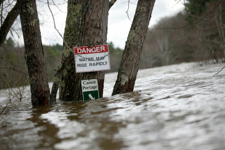
Maine continues to be mired in a cold and damp weather pattern that could increase concerns about flooding in some areas, especially with moderate to heavy rain forecast for Friday.
Many of the state’s rivers are running high, mostly from melted snowpack, and the National Weather Service has active flood warnings on two of them – the Kennebec River in Augusta and Skowhegan, and the Androscoggin River near the Maine-New Hampshire border.
However, Derek Schroeter, a meteorologist with the weather service office in Gray, said the next storm could makes things worse.
“We are watching another system moving in Friday because there is some concern that it will aggravate the rivers more,” he said. “What receding we are seeing is likely to bounce back up come Saturday.”
The St. John River in Aroostook County, for instance, had fallen from a high of 23.4 feet early Tuesday to 21.8 feet by noon Wednesday, the weather service said.
But 1-2 inches of rain could fall on Friday and Saturday and reverse that trend.
Flooding already has damaged more than two dozen homes in Fryeburg, most of them seasonal properties, where the Saco River flooded at Lovewell Pond on Monday. No one had to be evacuated but gas and propane tanks broke free from some residences, and Central Maine Power Co. had to cut electricity.
Schroeter said he’s heard concerns about the Saco River flooding in parts of Biddeford as well but there are no active warnings there.

Muddy water from the Saco River Reservoir courses over the dam at West Buxton on Wednesday. Press Herald photo by Ben McCanna
Susan Faloon, spokeswoman for the Maine Emergency Management Agency, said officials are actively monitoring several areas.
“For northern Maine, a flood advisory for rain and snowmelt is in effect for Eastern Aroostook County,” she said. “Emergency Management and law enforcement report continued minor flooding, with streams and rivers spilling over in places and flooding nearby lowlands and some roads. Some roads remain closed today.”

The Saco River overflows its banks Wednesday, flooding a private beach and a snowmobile trail near Canal Road in Hollis. Press Herald photo by Ben McCanna
Boston-based meteorologist and weather blogger David Epstein pulled data for the 365 days between April 25, 2018, and April 24 that showed 51.6 inches of total precipitation. That’s the 14th highest total for that 365-day period going back nearly 150 years.
The record was 63.4 inches in 1955-1956.
Schroeter said the dreary weather isn’t over.
After the Friday-Saturday storm, he said rain is expected Monday and then again next Wednesday.

A man surveys the Kennebec River from the edge of a flooded parking lot Monday on Front Street in Augusta as the river recedes. A flood warning remains in effect on the Kennebec in Augusta and Skowhegan, and conditions could worsen as more rain sweeps into the state Friday. Kennebec Journal photo by Andy Molloy
“We’re in a stretch where there isn’t more than a day or two between storms,” he said. “That’s somewhat typical of spring, but you like to see some dry weather to help the ground absorb all this moisture.”
Faloon said emergency officials are on notice, but cautioned residents to be mindful as well.
“We continue to monitor, as rivers and streams remain very high and we’re not out of the woods yet,” she said. “We do remind people to be aware of their surroundings, know their alerts and warnings, and to have a plan for evacuating or sheltering in place, if need be.”
Send questions/comments to the editors.


Success. Please wait for the page to reload. If the page does not reload within 5 seconds, please refresh the page.
Enter your email and password to access comments.
Hi, to comment on stories you must . This profile is in addition to your subscription and website login.
Already have a commenting profile? .
Invalid username/password.
Please check your email to confirm and complete your registration.
Only subscribers are eligible to post comments. Please subscribe or login first for digital access. Here’s why.
Use the form below to reset your password. When you've submitted your account email, we will send an email with a reset code.