
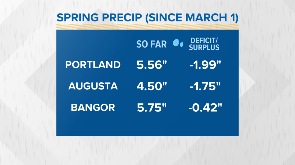
Maine’s rivers and streams are running high as the deep snowpack in the mountains has diminished rapidly in the last month. Despite the flooding, we’ve been relatively lucky so far. Total precipitation since March 1 is actually BELOW normal. Much of the flooding has been caused by the meltwater flowing into our river basins, and it’s been accelerated by our recent rain.
If a nor’easter or coastal storm stalled and dropped several inches of rain, which can happen this time of year, it would be a worst case flooding scenario.
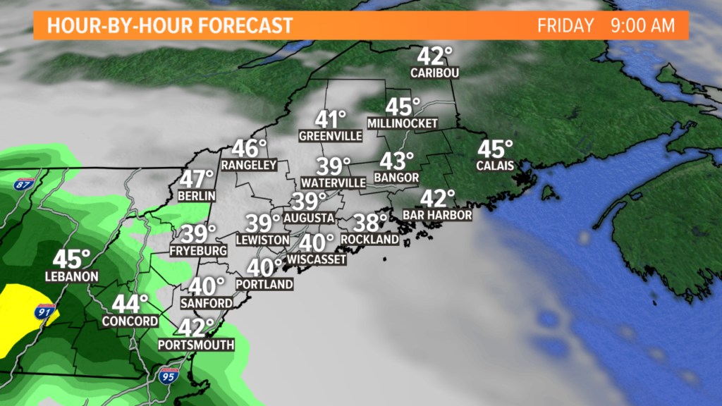
If you’ve felt the lack of sun lately, make plans to get outside Thursday: We’ll have a mix of sun and clouds with highs in the 50s for most, some inland towns will reach 60.
The break is short-lived. The next rainmaker moves in Friday afternoon, and may lead to additional flooding over the weekend.
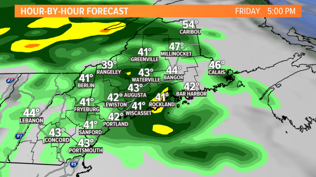
Plan on periods of rain Friday night, with another surge of showers and downpours likely to start the day Saturday.
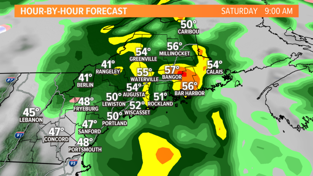
Saturday will be slow to clear out in most of the state, with lingering showers likely in central and northern Maine. Southern Maine has the best shot at afternoon peeks of sunshine.
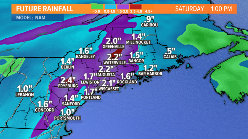
In total, another 1 to 2 inches of rain is likely between Friday afternoon and Saturday afternoon. The rivers will be on the rise and more flooding is likely, especially on rivers like the Saco, Kennebec, and Mattawamkeag, which are all running high.
The model shown below is the most aggressive scenario, with some towns topping 2 inches of rain, but this is certainly a possible outcome.
Stay with us, we’ll keep you posted.
Comments are no longer available on this story