
Historic spring snow is on the way just in time for Mother’s Day weekend. It’s not really the forecast snow amounts, but rather the timing of this impressive, anomalous, late season storm.
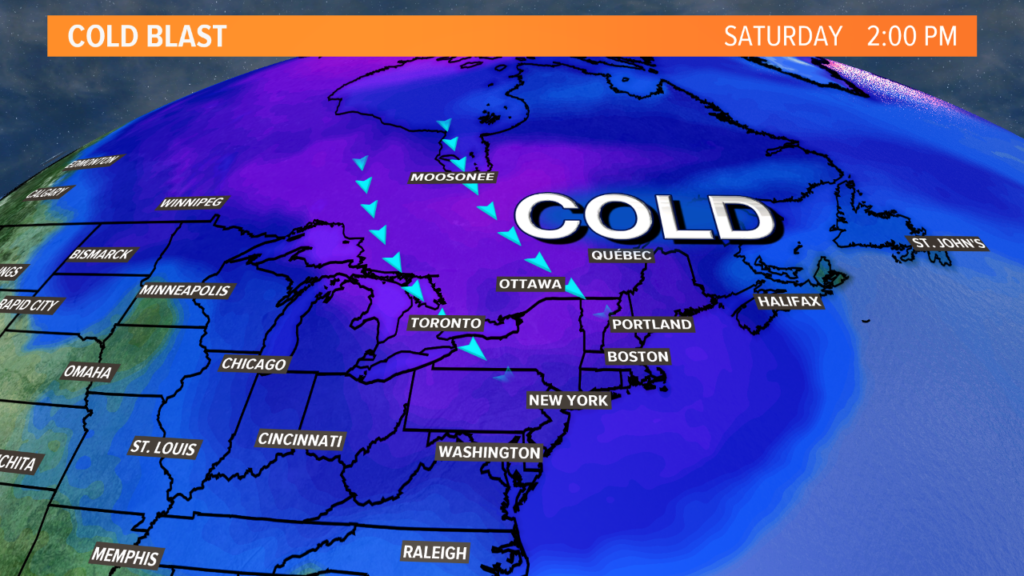
A storm is forming to our west. Late Friday night, it will track through the Gulf of Maine where it begins to strengthen rapidly.
As the storm becomes stronger, it taps into some Arctic air and pulls it into Maine.
The result is a chance of wind, rain, snow, and a cold weekend. How much snow is on the way? And how does this compare to other May snowstorms?
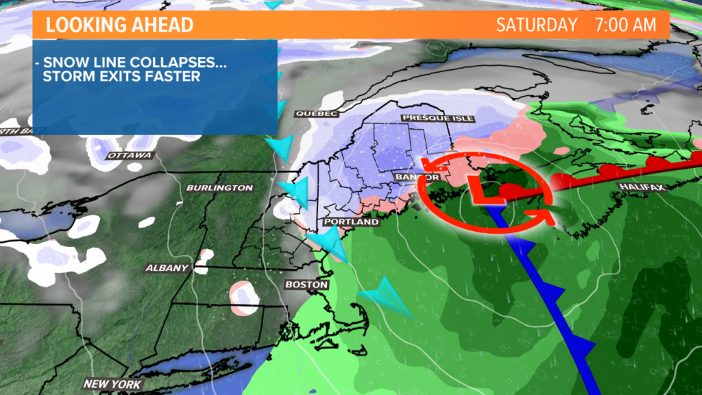
As the storm builds late Friday night, most of southern Maine will still be above freezing. The first batch of precipitation to fall will be rain, except in the higher elevations.
By sunrise on Saturday, colder air will get pulled into Maine. This is impressively cold air for this time of year.
Temperatures will likely still be above freezing near the coastline. In the mountains, temperatures will be colder – especially through the highest peaks of Maine.
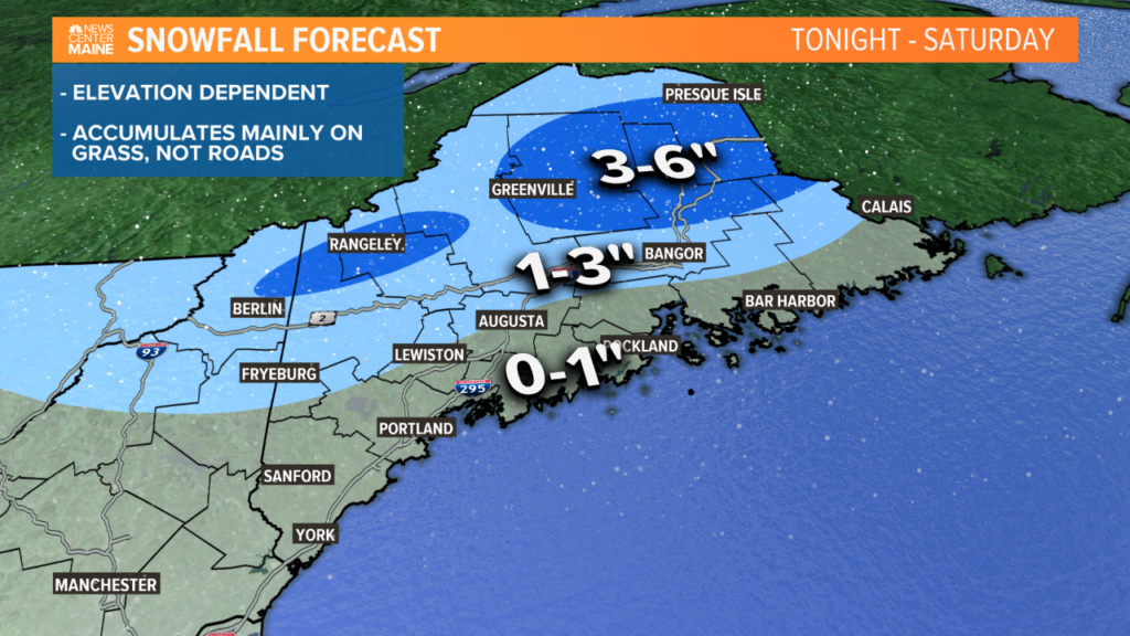
Snow will accumulate from Fryeburg to Bangor to Charlotte and points north. The highest totals will be 3-6″. This is where we could see some isolated power outages, though I don’t think it will be a huge issue.
For Lewiston and Augusta, a little bit of accumulation looks possible. It will mostly be on grassy areas and colder, elevated surfaces, like decks.
Along the coastline, expect mostly rain, with some flakes mixed in.
It’s worth mentioning that a lot of factors are working against us to allow snow to accumulate. Even behind clouds and with Arctic air in place, the sun is wicked strong this time of year. It’s hard to keep things like roadways cold unless it’s at night.
On the bright side, you won’t have to shovel. This snow won’t stick around long.
Showers continue in eastern Maine through the afternoon with some lingering flakes in the mountains. In southern Maine, a few breaks of sunshine are expected.
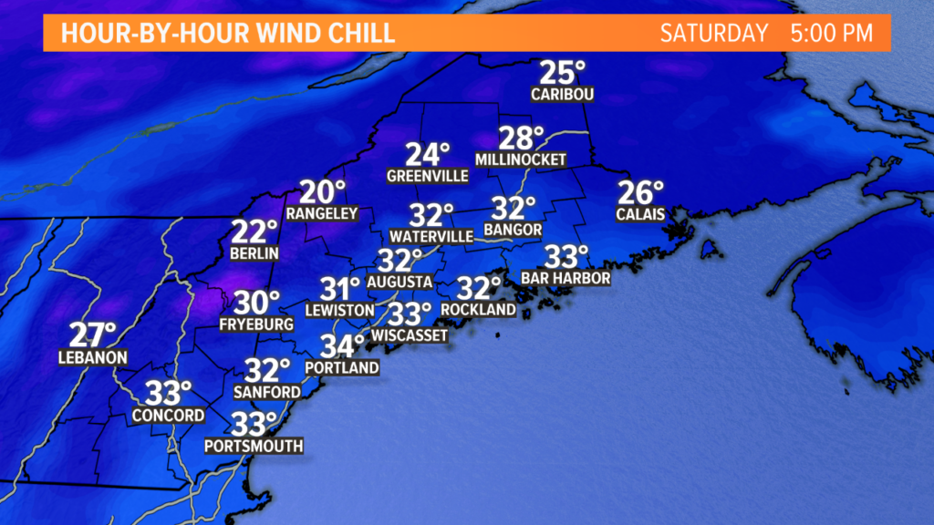
Gusty northwest wind will accompany temperatures in the 30s and 40s Saturday afternoon.
It will likely feel more like the 20s across the mountains and 30s in the lowlands, which is extremely chilly for this time of year.
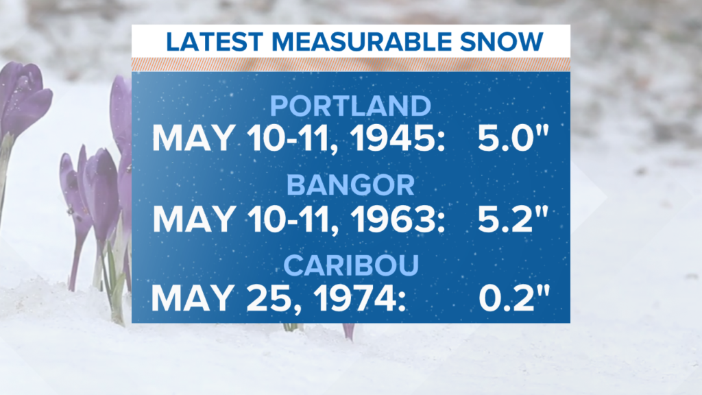
In Portland and Bangor, the latest accumulating snow on record is May 11. While this would be happening on May 9, 2020, it would still be the second or third latest snowfall on record if accumulation occurs.
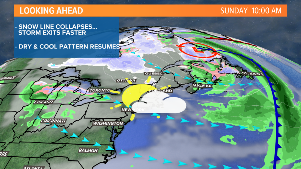
Sunday is a bit of an improvement, though still not great. If you got mom a jacket for Mother’s Day, this would be the perfect year to try it out the day she gets it.
The breeze continues on Sunday with high temperatures only in the low 50s. The sun will be out, though, so that will make it feel just a little bit warmer outside.
I don’t want to get ahead of myself here, but this is the last bit of really cold and active weather for the next week, with moderate temperatures in the low 60s late in the week, with abundant sunshine.
For more forecast information and random weather statistics, follow me on Twitter and Facebook.
Comments are no longer available on this story