
Ahhh, November. It’s that month that isn’t quite sure if it’s fall or winter. Sunny, warm days and snow are all in the cards…sometimes only a couple days apart!
That’s exactly how this week is going to unfold.
On Monday, a cold front will pass through Maine as a storm starts to rapidly strengthen to our east. These will be the main ingredients for weather at the start of the week.
Rain wraps up on Monday morning for most. Colder, drier air will begin to sink in after the moisture moves out.
The exceptions here will be sections of The County and the mountains where cold air rushes in before the moisture leaves. Snow totals are not too impressive, but it could be enough to cause some slick roads here or there.
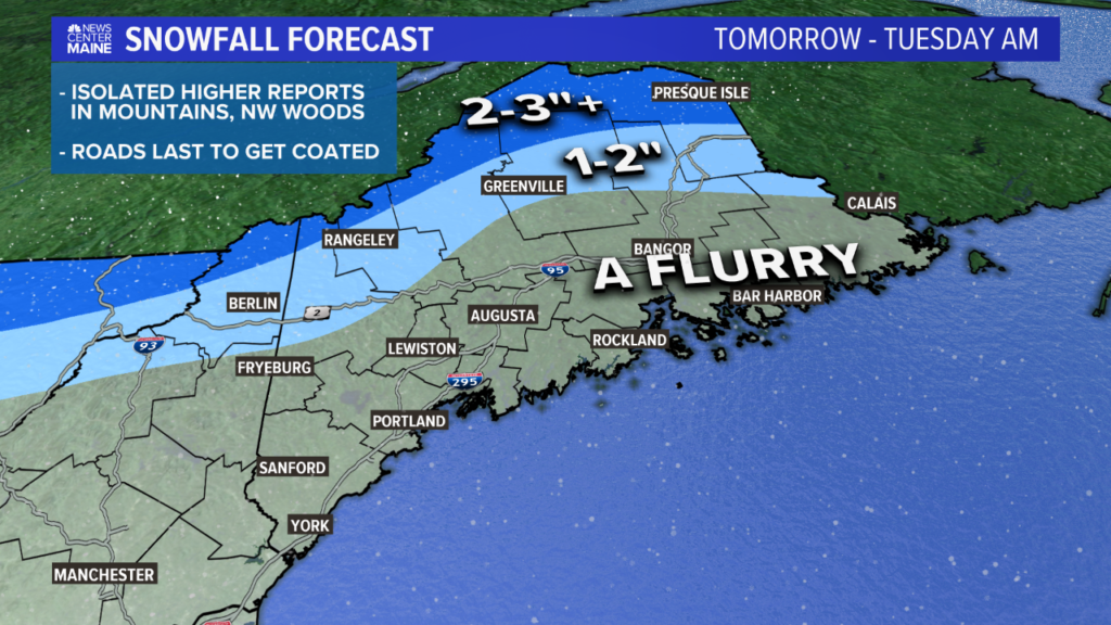
There could be a couple of isolated reports totaling 4″ of snow on some of the high peaks or right along the Canadian border. In general, cold air chasing moisture never results in much snow.
While a bit of snow is always exciting this time of year, wind will likely have a bigger impact for most people on Monday.
After the frontal passage Monday morning, the wind direction shifts to be out of the west. Sustained winds will be between 15 and 30 miles per hour.
As the wind field strengthens in the early afternoon, expect gusts to approach 30 to 40 miles per hour in most of central, northern, and eastern Maine.
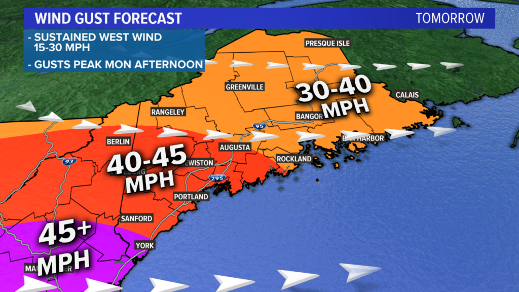
The foothills down to the Midcoast will see some stronger gusts. While I kept this region in the 40 to 45 mph range, there could be a rogue gust above 45 mph here.
I think the best chance at registering a gust over 45 mph will be far southern York county and southern New Hampshire.
It’s possible that a gust to 50 mph gets registered, but I think the chances of actually getting there are still somewhat low.
Generally speaking, widespread power outages do not seem likely at this time. Given the wind direction, lack of 55 mile per hour gusts, and bare trees, I don’t anticipate a lot of damage.
As always, though, a few isolated incidents will probably pop up.
The dropping temperatures and strong wind gusts spell out a cold afternoon and evening on Monday.
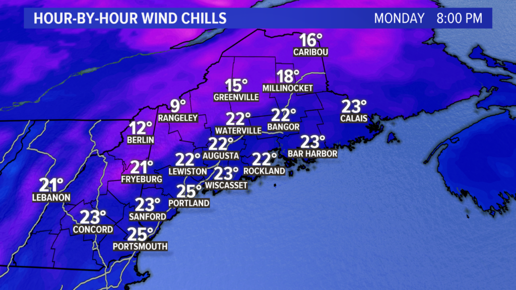
Temperatures will be falling into the 20s and 30s, especially after sunset. It will feel more like the teens and 20s after you factor in the colder wind.

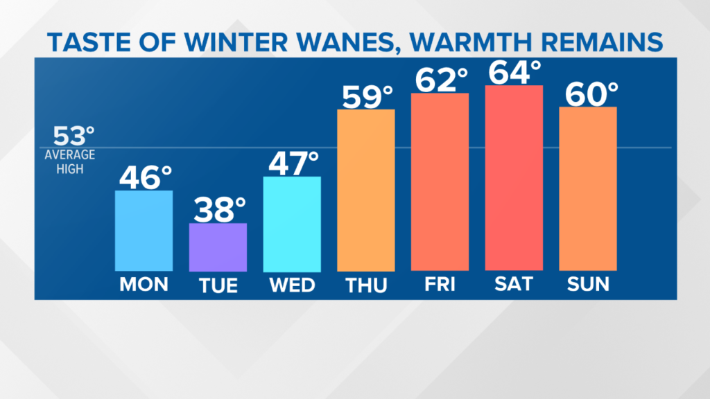
Election Day also looks cold and blustery on Tuesday. Might be a good idea to grab a heavy jacket when you head to the polls, just in case you have to wait in a line.
There could be a stray flurry or two on Tuesday morning as a weak disturbance passes south of us. High temperatures struggle to break 40 degrees.
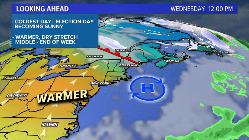
A warm front will roll north on Wednesday. Expect some cloud cover, given the frontal passage. Showers seem unlikely right now.
The afternoon will feature temperatures returning to be near 50 degrees with some sun mixing in later.
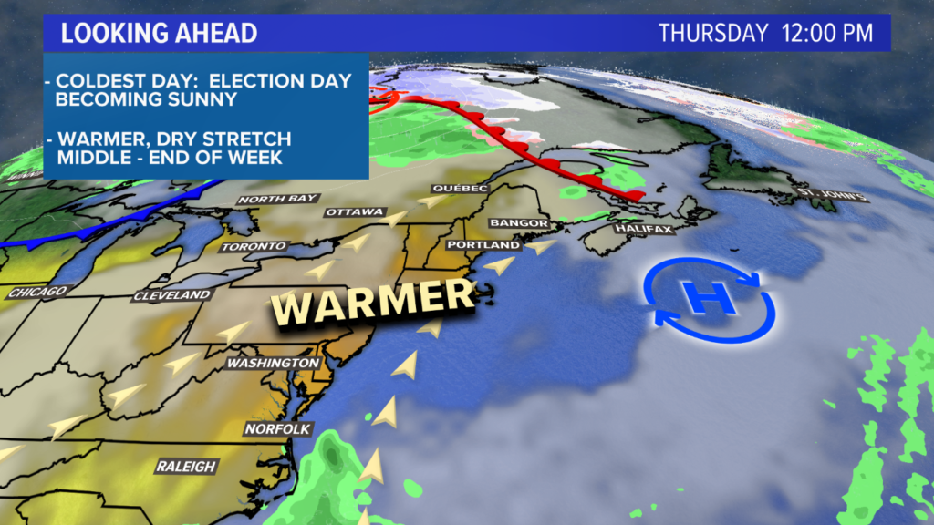
A quick glimpse ahead reveals a much warmer and calmer end to the week. I’m thinking most spots will be near or above 60 degrees for at least Thursday through Saturday, but Sunday is trending a bit milder. It’s worth it to enjoy some nice days after this unseasonably chilly start to the week.
I’ll leave you with this temperature trend graphic over the next week. Not too bad at all if you ask me!
For the latest forecast information, follow me on Twitter and Facebook.
Comments are not available on this story. Read more about why we allow commenting on some stories and not on others.
We believe it's important to offer commenting on certain stories as a benefit to our readers. At its best, our comments sections can be a productive platform for readers to engage with our journalism, offer thoughts on coverage and issues, and drive conversation in a respectful, solutions-based way. It's a form of open discourse that can be useful to our community, public officials, journalists and others.
We do not enable comments on everything — exceptions include most crime stories, and coverage involving personal tragedy or sensitive issues that invite personal attacks instead of thoughtful discussion.
You can read more here about our commenting policy and terms of use. More information is also found on our FAQs.
Show less