
Less than two weeks remain in 2020. What better way to get through it than a big ol’ storm on Christmas? And it’s not even a snowstorm! I wish this wasn’t the case, but it looks like there could be some nasty weather on the holiday. Let’s start off with the days leading up to Christmas…
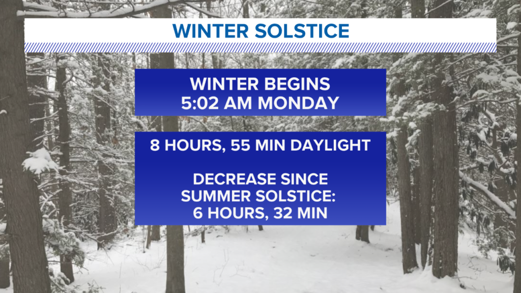
The winter solstice happens early Monday morning. That means Monday is also the shortest day of the year! Starting Tuesday, days slowly get longer and nights get shorter. That will be the case, of course, until the summer solstice in June.
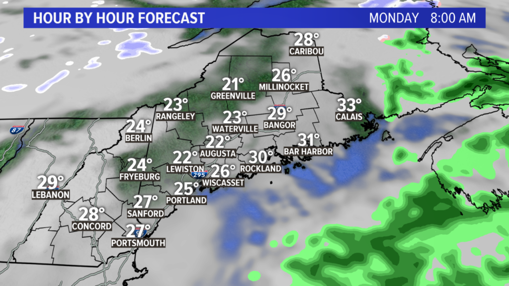
A coastal storm passes south of Maine during the day on Monday. The rain stays away, but the clouds will keep skies gray.
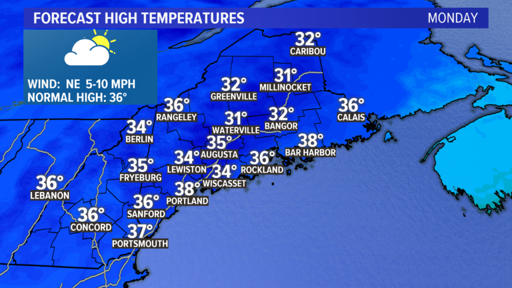
Most spots top out in the mid to upper 30s. More snow will melt during the day, priming the roads for some black ice overnight and into Tuesday.
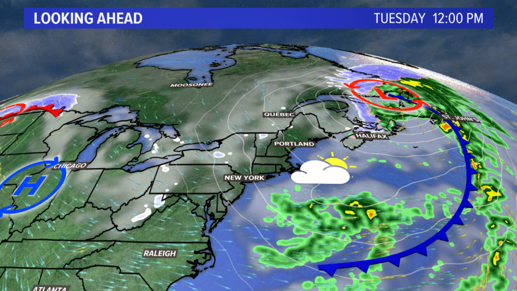
A blustery day is expected Tuesday with mostly cloudy skies. Some snow showers move through the high elevations. Highs again return to the 30s. The breeziest part of the day will be the afternoon, but that will relax late Tuesday night.
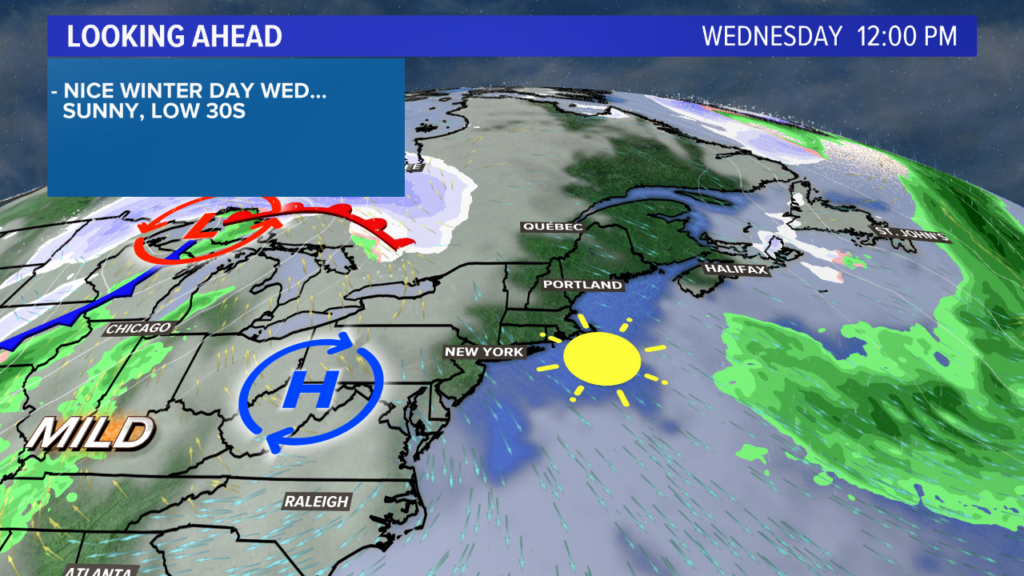
Wednesday will be, unequivocally, the quietest weather day this week. Sunshine and temperatures between 35° and 40° will make it feel great out there! Which works for us, since we’ll be able to focus all of our attention on what’s to come.
Quick note: there are still some timing differences on this storm. Once Monday afternoon rolls around, we should have a more concrete idea on exactly when heavy rain and strong wind gusts will be a threat. Until then, expect it some time between Thursday evening (Christmas Eve) and noon Friday (Christmas Day).
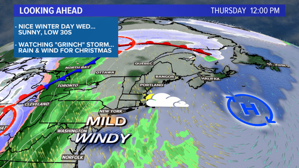
A powerful storm will be moving through the Great Lakes region, dragging a strong cold front with it.
Ahead of this storm, warm air pours into Maine. High temperatures on Thursday will make it into the 40s, despite the increasing cloud cover. Expect a few breaks of sun early followed by overcast skies in the afternoon.
By Thursday night, it will be time to watch for heavy rain. Temperatures stay above freezing since the warm air continues to move on in.
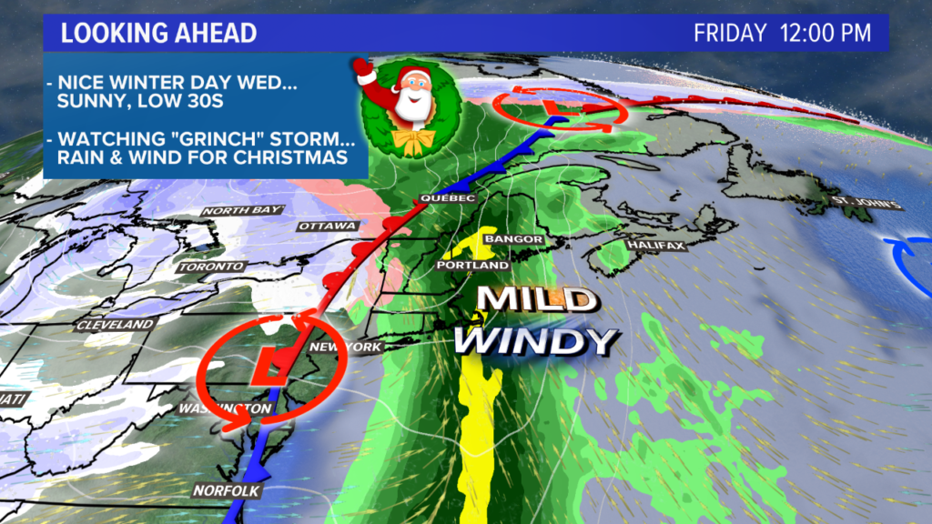
The heavy rain continues into Friday morning. The threat for strong wind gusts will coincide with the timing of the heaviest rain. It could be some time late Thursday evening or Friday morning.
Temperatures may also surge on Friday. The record high in Portland is 62 degrees, set in 2015. I’m not sure we’ll get that warm, but mid 50s seems like a fair bet if the cold front lags a little bit.
Possible impacts from this storm include potential for flooding. Melting snow and heavy rain could cause some water issues, especially in areas of poor drainage. Power outages will be possible if gusts get strong enough. Best chance will be near the coastline. Last but not least, the sudden warm up and moisture-rich air with ample snow on the ground should make things pretty foggy.
If there’s one thing for sure this year, it’s that we should expect the unexpected. We will be watching the storm as we get closer and providing weather updates. I’d at least plan on some heavy rain, though.
Oh … and I already called Santa, Rudolph is ready for the weather and the sleigh will be here as planned. No issues there!
For more forecast information, follow me on Twitter, @MikeSliferWX. Have a safe and happy holiday.
Comments are no longer available on this story