
It was beginning to look a lot like Christmas, but that’s all about to change. Say goodbye to the snowpack and get ready for yet another December storm that brings the threat for power outages and strong wind gusts.
A quick overview of this storm system shows a low pressure system in the Great Lakes region with a trailing cold front down the Appalachians.
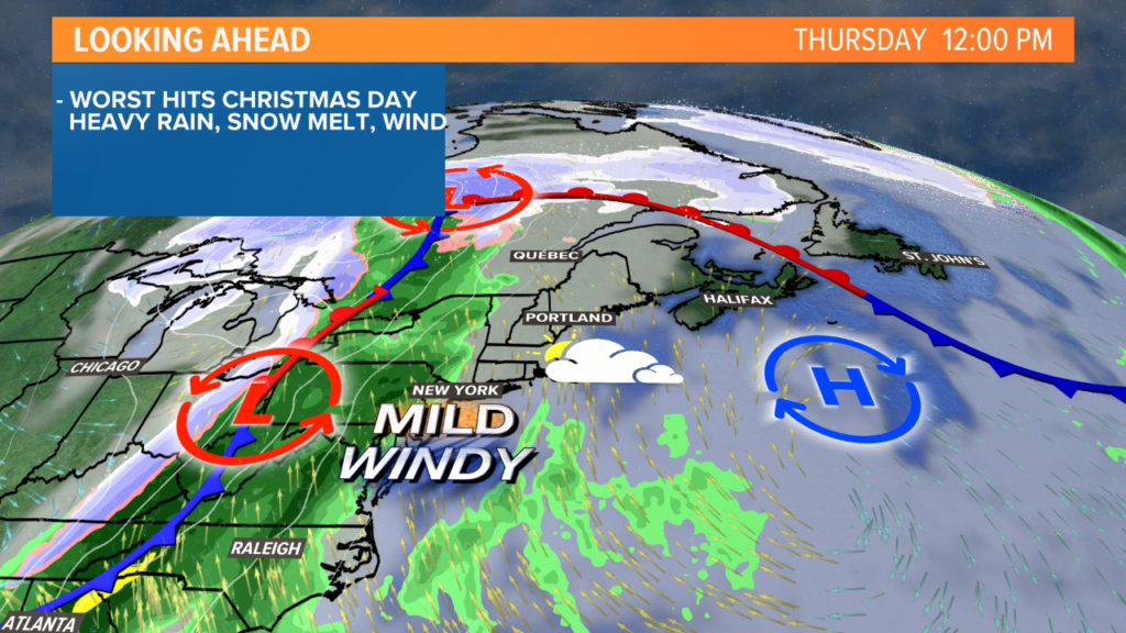
By midday Thursday in Maine, temperatures will be climbing and skies will be cloudy. High temperatures for most should make it well into the 40s. Don’t expect them to fall much overnight, either.
Fog is looking likely, too, as the warm and moisture-rich air moves in over the snowpack. This also is a big piece to why we will lose most of the snow that fell last week.
As the storm progresses east, wind gusts will pick up and rain gets closer.
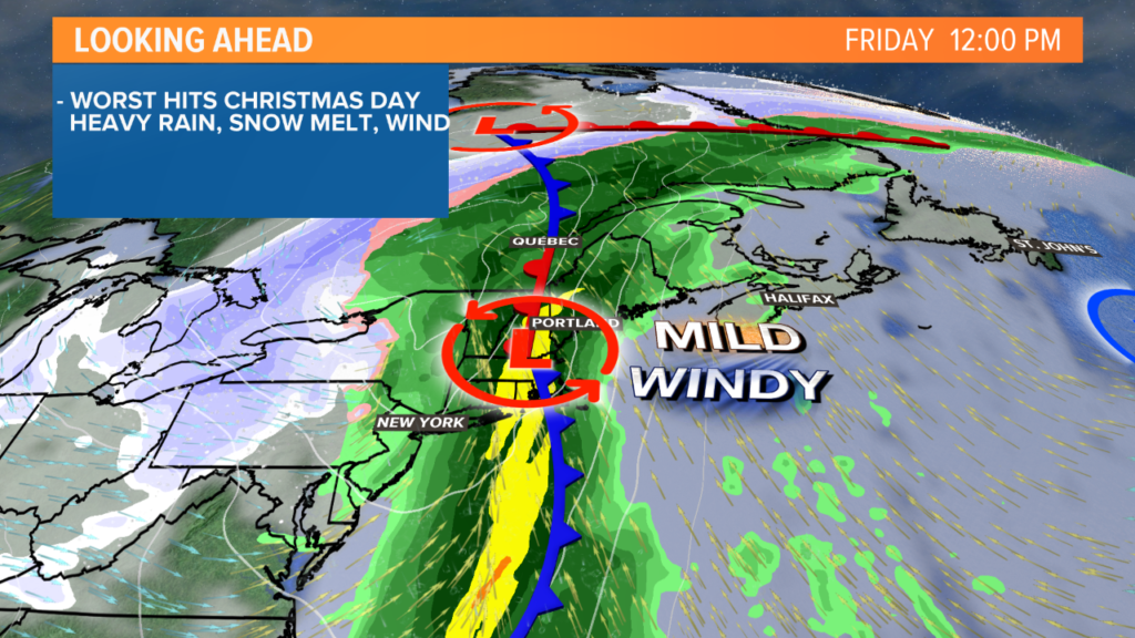
Overnight Thursday into Friday, expect wind to pick up out of the south. Sustained wind speed will be around 20-30 mph for the coastline, a little bit less inland.
This storm will have a wicked potent low-level jet (wind speeds over 75 mph only about 2,500 feet above the ground).
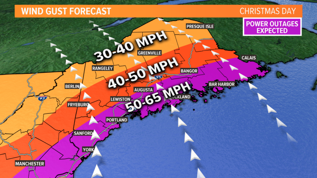
As the rain moves in, it helps to bring those stronger wind speeds down to the ground. This will lead to wind gusts approaching 55 mph or more, especially at the coastline. Some of the higher elevation areas will see strong wind gusts as well.
You know all of the beautiful holiday décor outside right now? It’s a good idea to bring that in – especially those big inflatable ones.
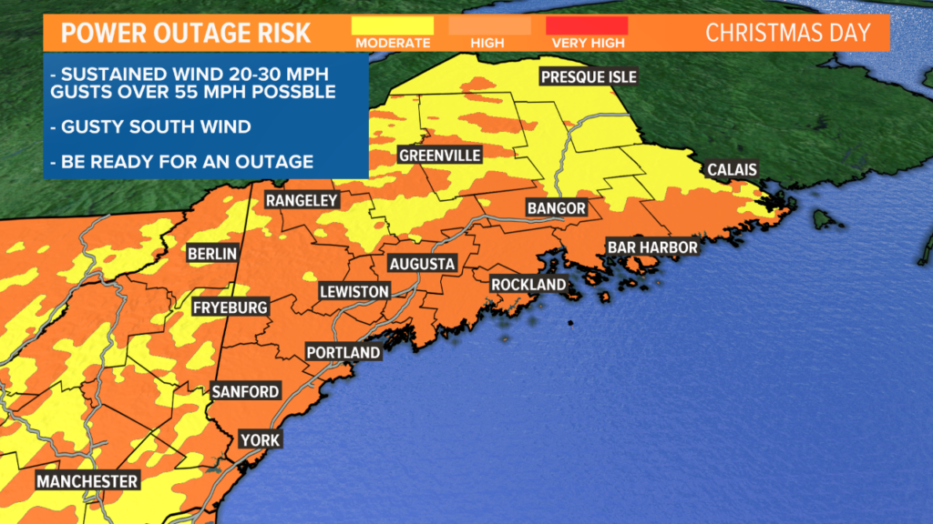
Given the wind direction and forecast gusts, outages will likely start up late on Christmas Eve. Unfortunately, I expect outage numbers to climb through Christmas Day, at least in the morning.
It’s a good idea to have a plan in case you lose power, since this storm has a setup that favors some stout winds.
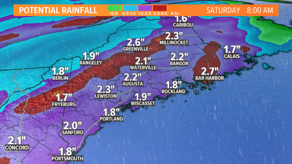
On top of the wind and outage threat, rain totals will be a widespread 1.5-to-2.5 inches. The southern-facing slopes of the mountains will likely make it past 3 inches of rain total, with isolated spots approaching 4 inches or more along the highest peaks.
Some streams and rivers might approach full banks with all of this rain and runoff. Additionally, keep an eye on storm drains. They sometimes get backed up with ice and snow, which leads to nuisance flooding in urban areas.
Last, but certainly not least, check your sump pumps if you tend to get water in your basement.
This is certainly not the forecast I wanted to give you for Christmas. However, it’s the forecast we get. Hopefully, you can safely enjoy the holiday with no weather interruptions.
Remember, never touch a downed wire!
I’ll have more coverage leading up to and during this weather event on my Twitter account, @MikeSliferWX.
Comments are no longer available on this story