
It’s the final few days of the year. In classic 2020 fashion, the end of the year features a tumultuous pattern and a tough forecast.
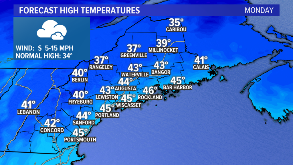
Monday will be fairly mild. Most make it into the mid 40s despite the cloud cover. Expect overcast conditions to last through the whole day.
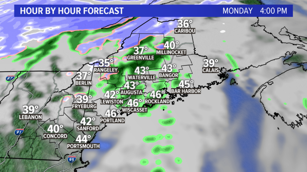
The clouds are thanks to a weak system passing to the west. Since Maine is on the warm side of this, most of the showers will be rain. There might be some snow that mixes in to the western mountains and northern areas, though.
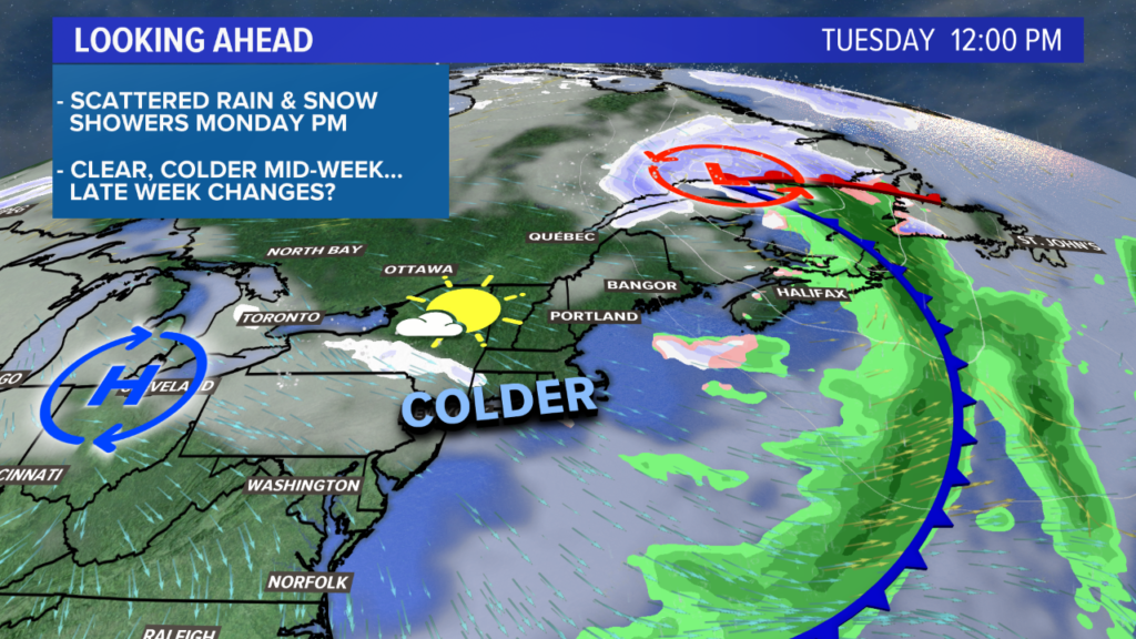
This storm is the key to ushering in some colder air.
Tuesday will be fairly breezy and much colder despite the sunshine.
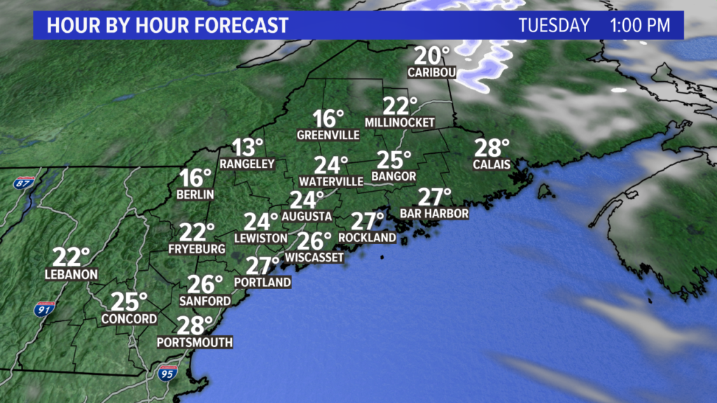
Most spots only make it into the 20s, with a smattering of low 30s along the coast by Tuesday afternoon.
It gets fairly cold overnight. If the breeze relaxes enough, though, temperatures will drop a bit more. Right now, expect teens at the coastline with some single digits inland.
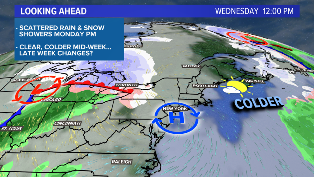
As the sun rises Wednesday morning with high pressure overhead, all eyes will be on the storm in the Midwest. Temperatures will mostly be in the mid to upper 30s by Wednesday afternoon.
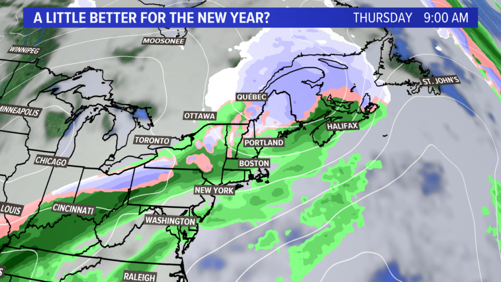
The forecast gets a bit trickier by Thursday, New Year’s Eve. There are a couple pieces of energy that will be moving through.
Right now, it looks like Thursday will be a cloudy day with some mixed showers around. High temperatures Thursday are expected to climb at the coast, possibly back into the mid 40s, as the storm passes west.
In the mountains and across northern sections of Maine, it will be a little colder and favor more wintry precip. Accumulating snow could be in the cards for the mountains, which is great news for ski resorts.
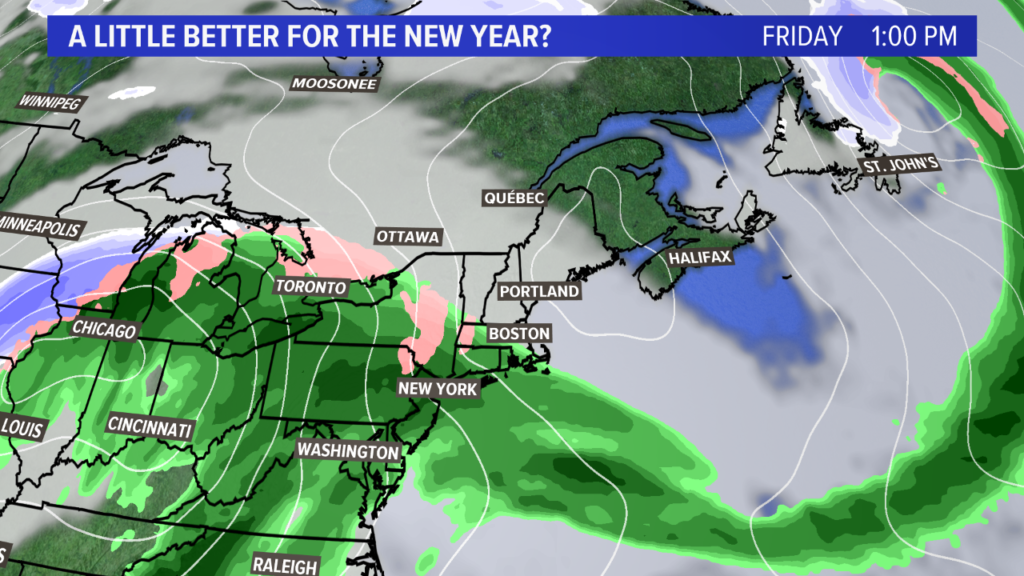
Friday looks colder, with clouds lingering. There’s a chance for some showers later on Friday evening, depending on the timing of the next storm.
A second storm moves in Saturday, which also brings some mix into the play.
I wish I had more pieces to the forecast puzzle, but it’s still four days out. Once we get closer, expect an updated blog from me.
Bottom line: this may not be as warm and rainy as the Christmas storm was, but I’m still expected some active weather to end of 2020 and start 2021.
Follow me for more updates on Twitter, @MikeSliferWX.
Comments are no longer available on this story