
This month’s storm track has been great if you hate the snow. If not, don’t expect a big change for the last week.

There have been a few squalls since we last spoke, bumping up recorded totals in Portland and Caribou a smidge.
Some flakes might be able to sneak in Tuesday night, too, but they likely will not amount to much at all.
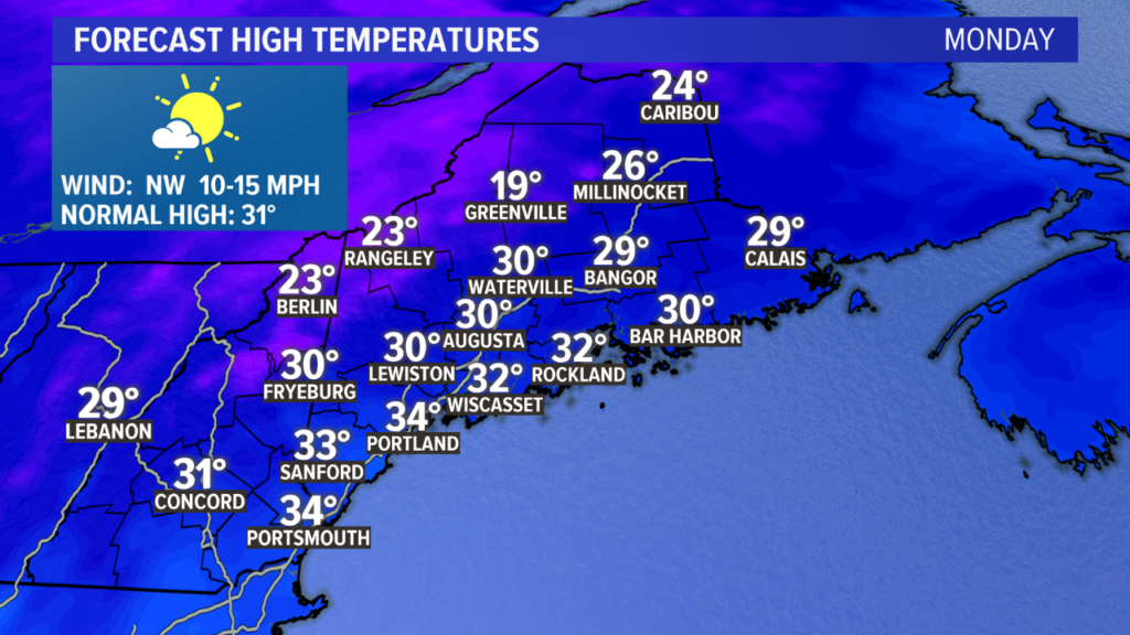
Monday looks like a fantastic January day. Temperatures will run in the upper 20s and low 30s with a lot of sunshine. It will be pretty cold to start, though.
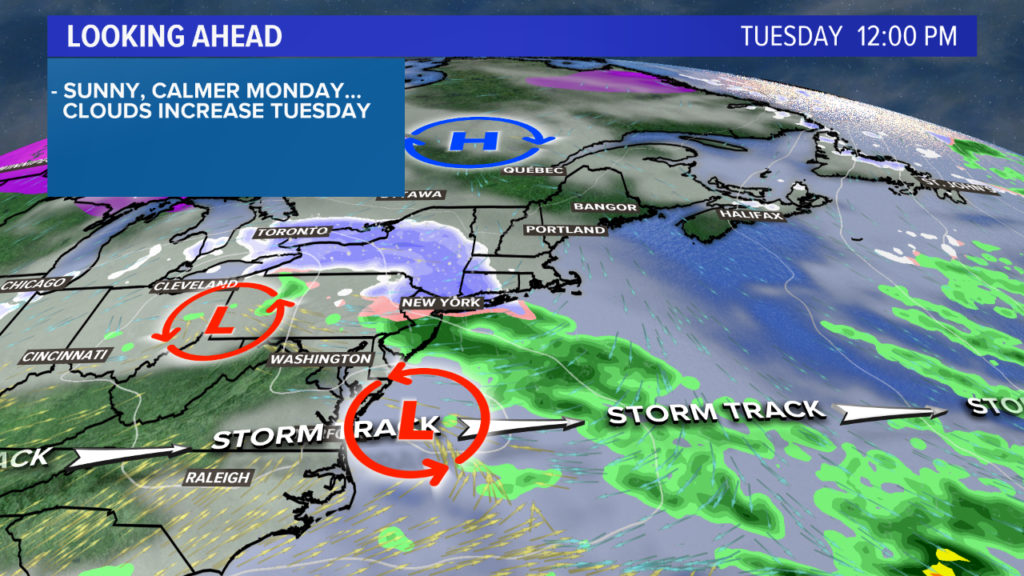
Sunrise should be pretty on Tuesday as high clouds move in.
By the afternoon, clouds thicken in southwestern Maine. Temperatures make it into the low 30s.
The entire state will be under cloud cover by the evening. A few flurries or even a light snow shower could pass Tuesday night into Wednesday morning, but the storm will stay to our south.
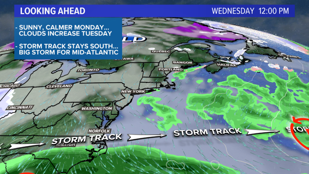
I originally though Wednesday would be a sunnier day, but the trends have been cloudier. It still should be a fairly quiet weather day with limited snow shower chances early.
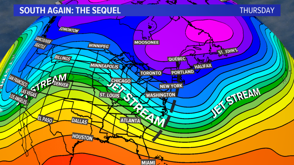
The storm track will likely stay south on Thursday yet again.
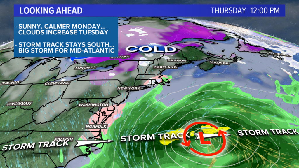
A strong storm will form in the mid-Atlantic. The details are still muddy, but these are the types of storms that could drop snow near Washington DC, in parts of Virginia, and in the Carolinas. Still a lot to figure out. It looks like my old stomping grounds in southern West Virginia could get some accumulation, too!
Where the details aren’t muddy, though, is here at home. Temperatures return to the 30s with mostly cloudy skies. Despite the clouds, snow manages to miss us yet again.
Wind gusts start to pick up late Thursday, and breezy conditions hold through Saturday.
A few flurries will be possible again on Friday, but accumulation still looks unlikely.
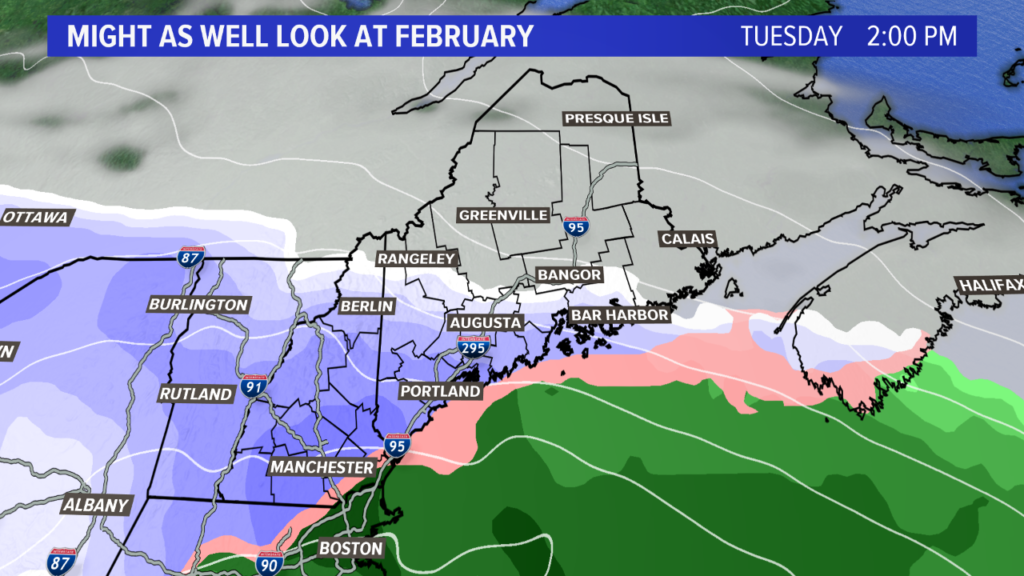
I’ve been digging into the details and the next plausible storm threat for us is not until the start of February. Since this is a solid 8 days out, don’t take it verbatim. Just keep an eye out for any stormy headlines to kick off the new month.
For other forecast information and to see pictures of the snow in WV (should any fall), follow me on Twitter, @MikeSliferWX.
Comments are no longer available on this story