
A weak system on Friday will bring some snow to inland sections of Maine.
While sunshine is expected early in the morning, cloud cover quickly moves in.
Showers are quick to follow the clouds.
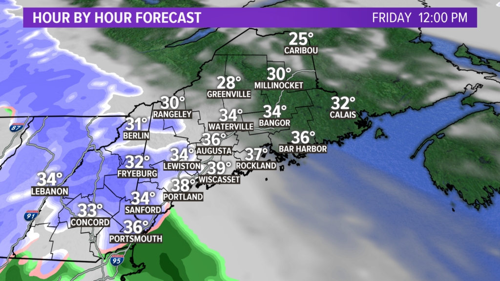
In the late morning, snow showers start up from Rangeley to Kittery.
Despite some fat flakes falling along the coast, I don’t think it will stick. Temperatures should be sitting slightly above freezing by noon.
Inland, though, that will not be an issue.
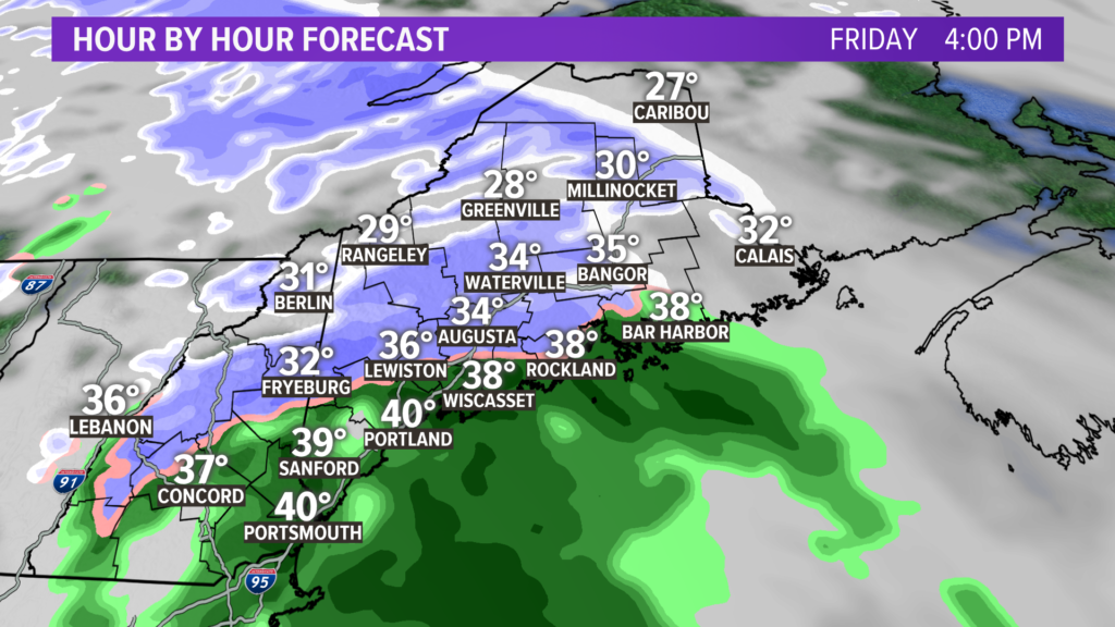
Eventually, the rain snow line gets pushed inland. Expect a switch from snow to rain through the Sebago Lake are up to Lewiston and Augusta. This is roughly where I expect the rain/snow line to sit.
Given the timing, the evening commute could be pretty slick for some. Plan that in to your commute and take it slow.
Route 302 and Route 202 should see rapidly changing conditions as you travel them further inland, which could complicate the drive a bit, too.
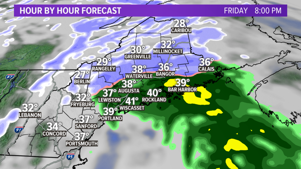
The light snow and rain clears from west to east through the evening on Friday. Some lingering slick spots are expected as temperatures dip back into the 20s overnight.
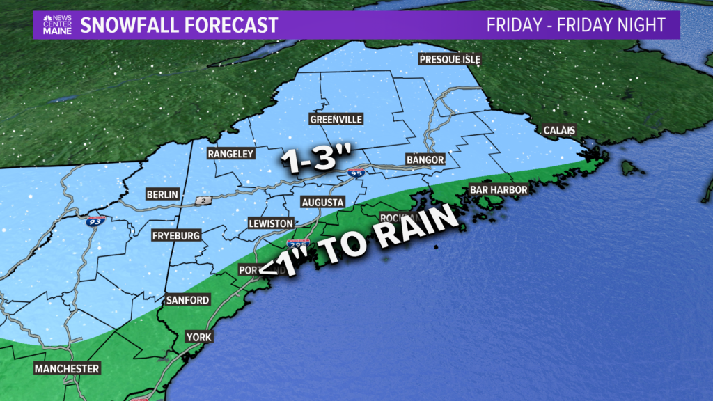
Not exactly a big one, but here’s the latest snowfall forecast.
Again, this will be mostly rain at the coastline.
Next time frame to watch is Sunday…the trends suggest watching for a return of that coastal storm. Details are a bit muddy right now, though!
For more forecast info, follow me on Twitter, @MikeSliferWX.
Comments are no longer available on this story