
Full disclosure on this blog: forecast uncertainty is high after Wednesday since this pattern is so volatile. There are lots of signals for rain, but timing out when the drops fall is pretty tough. Monday through Wednesday will be a bit more detailed with timing than the end of the week.
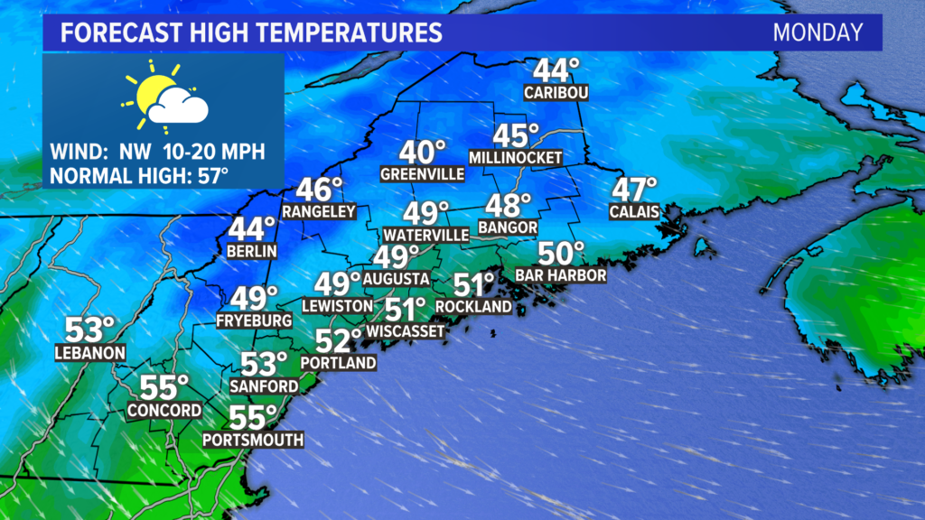
After a gorgeous Saturday and gloomy Sunday, Monday will feel much cooler. High temperatures stay below 55° just about everywhere. To add insult to injury, wind gusts pick up out of the northwest.
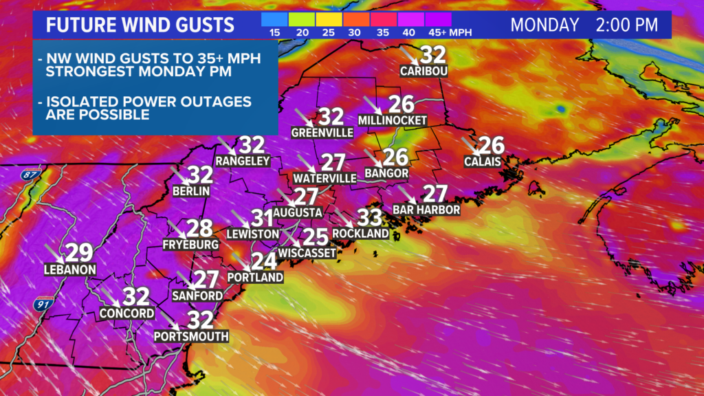
Gusts peak in the afternoon, with the strongest around 35 mph. A couple of isolated power issues may pop up, but damage is generally not an issue until gusts get above 45 mph.
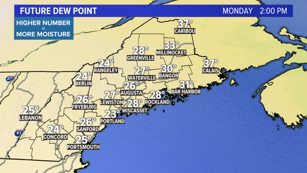
The bigger issue with wind is how dry it will be. With humidity so low and bare ground, wild fire risk goes up. Follow burn laws and use care with anything that could spark a fire. A reminder: lower dew points mean less moisture in the air.
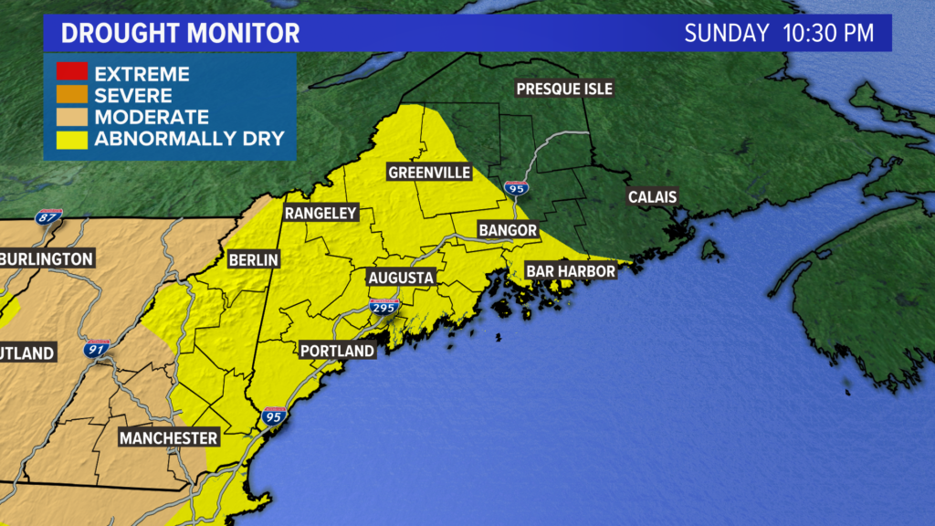
Despite the rain last week, the abnormally dry area in Maine still covers over half of the state. Hopefully the rain chances this week address this a bit.
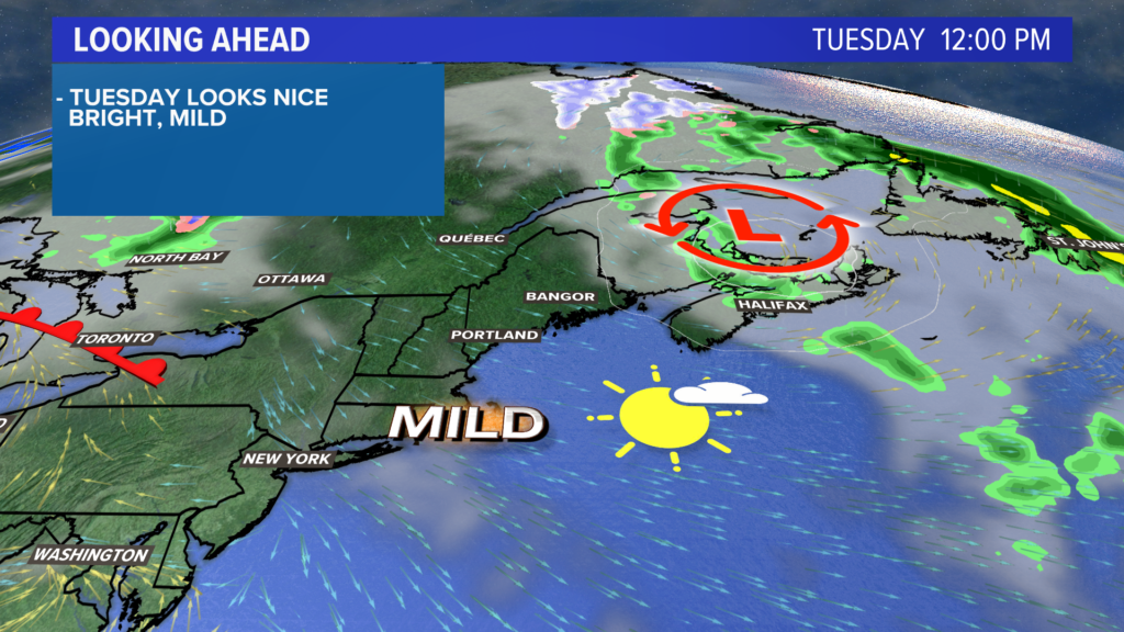
Tuesday will be much nicer than Monday. Temperatures will be pretty mild, with most in the mid 60s. It could be a little breezy still, but not nearly as windy as Monday.
Partly to mostly sunny skies are also expected Tuesday afternoon. Personally, I say this is the “pick of the week” for nice weather.
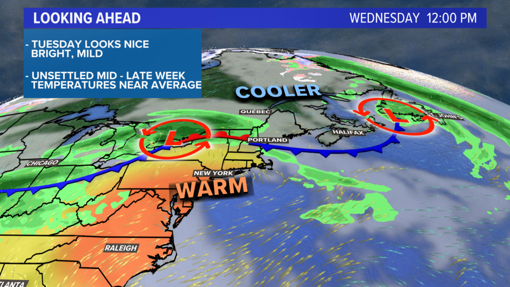
The forecast gets a bit more complicated after this.
For starters, warmer air will be attempting a northward surge, while cooler air is slow to retreat.
When air masses collide, it means one thing: showers and storms. Maybe that’s two things. Either way, unsettled weather is likely in the afternoon.
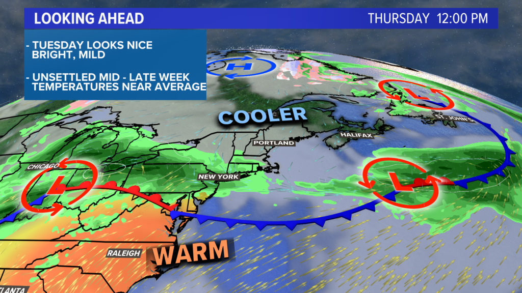
For now, I think cooler air will try to move in on Thursday. Given the upper air temperatures, sunshine would still put us into the upper 50s or even low 60s.
Rain tries to build for Friday, with a better chance for rain in the morning than the afternoon.
With a bit of luck, the sun will be back in full force next weekend and temperatures return to the 60s.
For forecast updates, follow me on Twitter, @MikeSliferWX.
Comments are no longer available on this story