
Henri made landfall on Sunday afternoon, weakening significantly as it moved inland.
We’re not *quite* done with the Henri forecast, though.

Monday will be another cooler day, with temperatures in the 70s. Expect abundant clouds and occasional downpours.
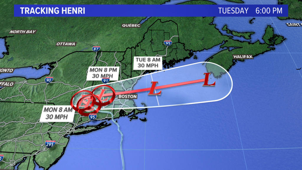
Henri is forecast to move east, entering the Gulf of Maine late Monday or early Tuesday. This will feed the rain showers Monday, and also bring some unsettled weather for Tuesday.
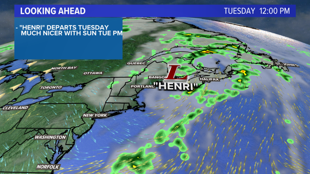
As Henri’s remnants roll past, one last batch of heavy rain is likely Tuesday morning. This should put storm total rain (Sunday through Tuesday) in the 1-2″ range near Portland, with some locally higher amounts possible in western Maine. Sunshine returns in the afternoon as the clouds finally clear out.
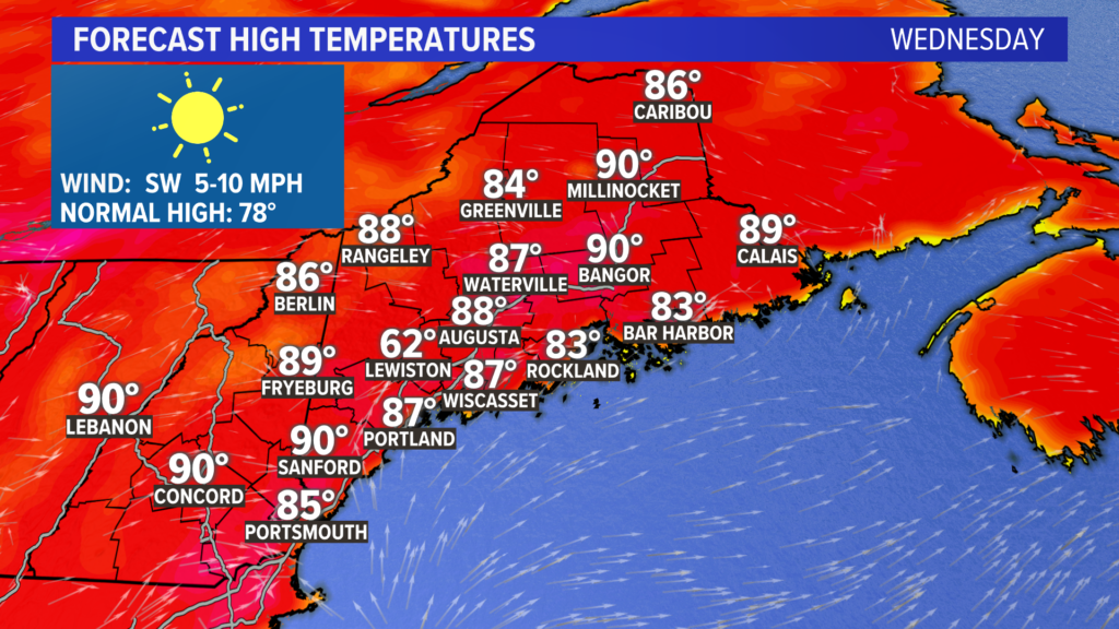
Heat is back on Wednesday under hazy, sunny skies. Temperatures likely climb into the upper 80s and low 90s.
Add in the humidity, and it’s going to feel quite hot. Again.
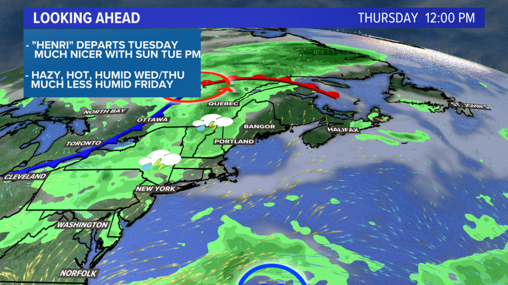
A cold front late Thursday will bring relief, but only after one last hot day. Thursday should be another day with highs reaching well into the 80s.
The front passes Thursday night and brings some showers or storms with it. Severe weather seems unlikely right now.
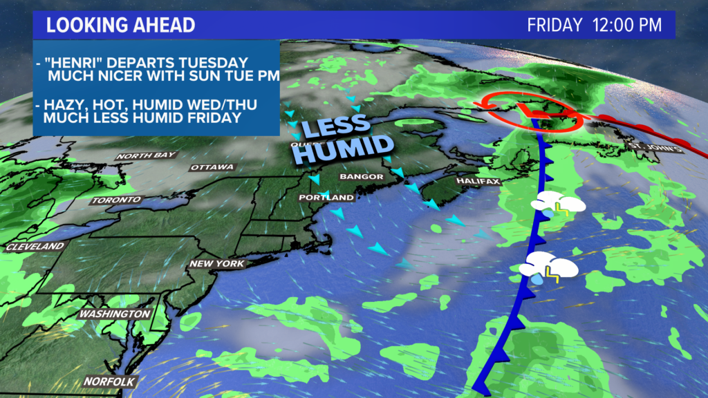
Less humid (but not totally dry) air rolls in behind the front Friday.
If I had to pick the nicest evening to be outside, Friday might take the cake. It will be the only one that’s not overly humid or rainy this week.
Maybe the weekend will stay dry, too.
For the latest forecast info, follow me on Twitter, @MikeSliferWX.
Comments are no longer available on this story