
The second week of March is shaping up to be fairly mild, but it comes at a cost: rain.
I know, this is not the type of weather you want to accompany these warmer days, but it’s still beneficial for us.
For one, it will wash the salt off of the roads. That alone is a win.
The generally active pattern is also what keeps reinforcing the warmer air, allowing for highs to remain above normal for most of the week.
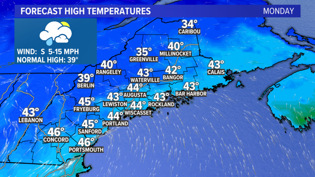
Most high temperatures on Monday will be in the 40s. Melting continues, which will probably mean bare backyards for many by the end of the day.
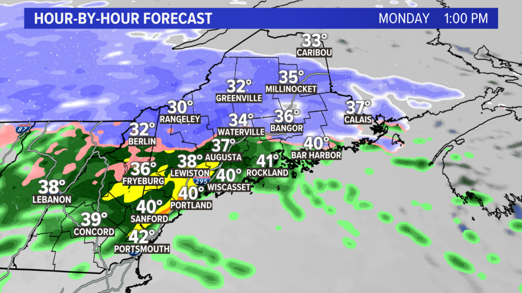
This will also be due to the first round of rain that rolls in.
While this model shows snow across the mountains, I expect more of a wintry mix or even just some cold rain.
Impacts should be minimal and the flood risk remains quite low.
Wind gusts will pick up a bit in the afternoon.
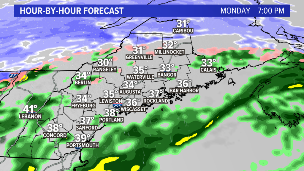
There will be a lull in precip through the late afternoon and early evening.
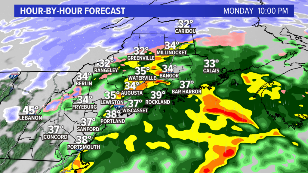
We’re not quite done with the rain yet, though.
A secondary round of rain rolls through as the cold front finally passes.
Believe it or not, this second batch of rain might have just enough juice for a couple rumbles of thunder.
Colder air starts to pour in behind this front.
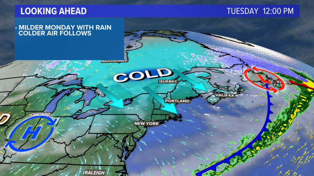
Tuesday will be colder, with temperatures struggling to hit 40°.
A gusty northwesterly wind will also have an impact on being outdoors, making it feel even colder than it is.
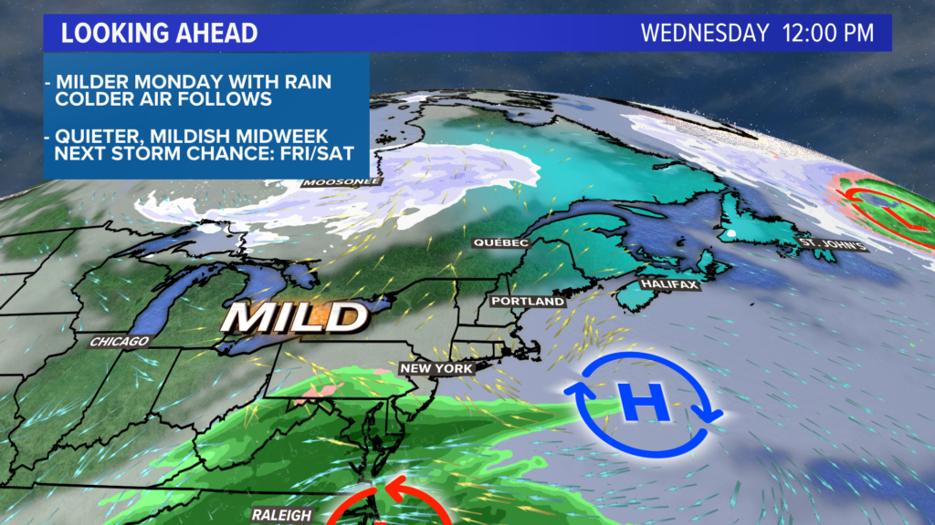
High pressure shifts east, putting Maine back into some southwest winds on Wednesday.
The combination of wind direction and some sun will help push temperatures back into the mid 40s, a few degrees above normal for mid-March.
The day looks pretty quiet, too, all things considered. It should be good weather to get outside.
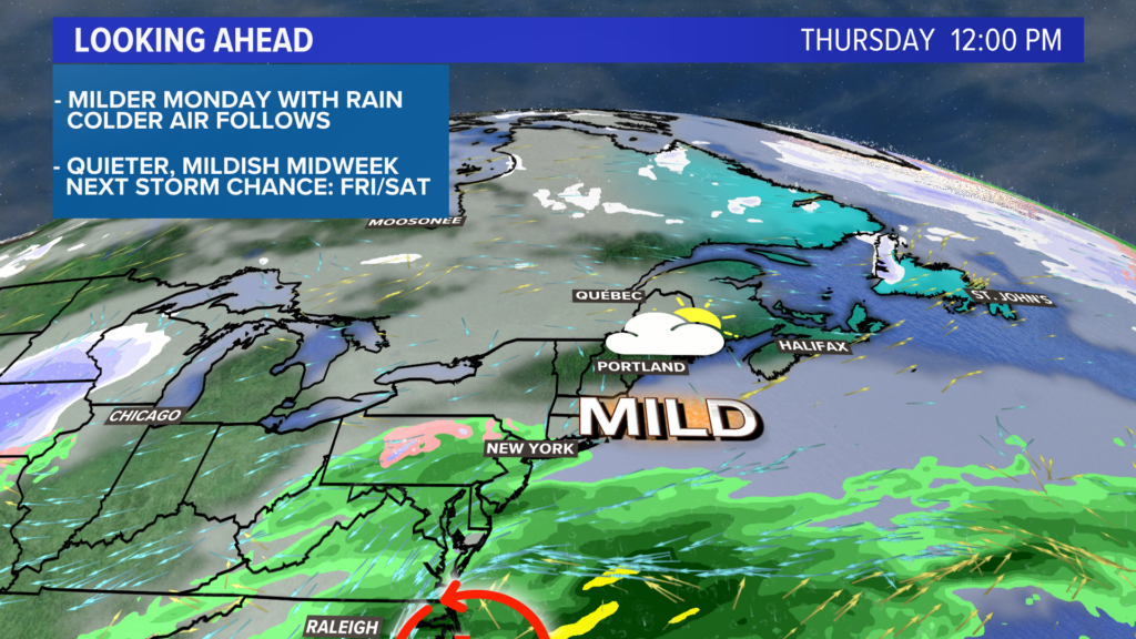
High pressure will help suppress the storm system Thursday.
Expect rain to stay south of Maine, with clouds increasing across the state. Mostly cloudy skies are expected with high temperatures back into the mid 40s to low 50s.
These clouds will linger, though, as the next storm gears up to roll through.
That will happen sometime on Friday or Saturday. Both rain and snow are a possibility depending on the track, but rain is a little more likely at this time.
I’ll have updates on that this week.
For more, you can follow me on Twitter, @MikeSliferWX.
Comments are no longer available on this story