
I’ve got some updates on the midweek rain potential, and I don’t think it’s the update many wanted to hear.
The old adage of “drought begets drought” could not be truer this year. Southern and central Maine have not been able to buy significant rain, while northern Maine sits with a nice surplus.
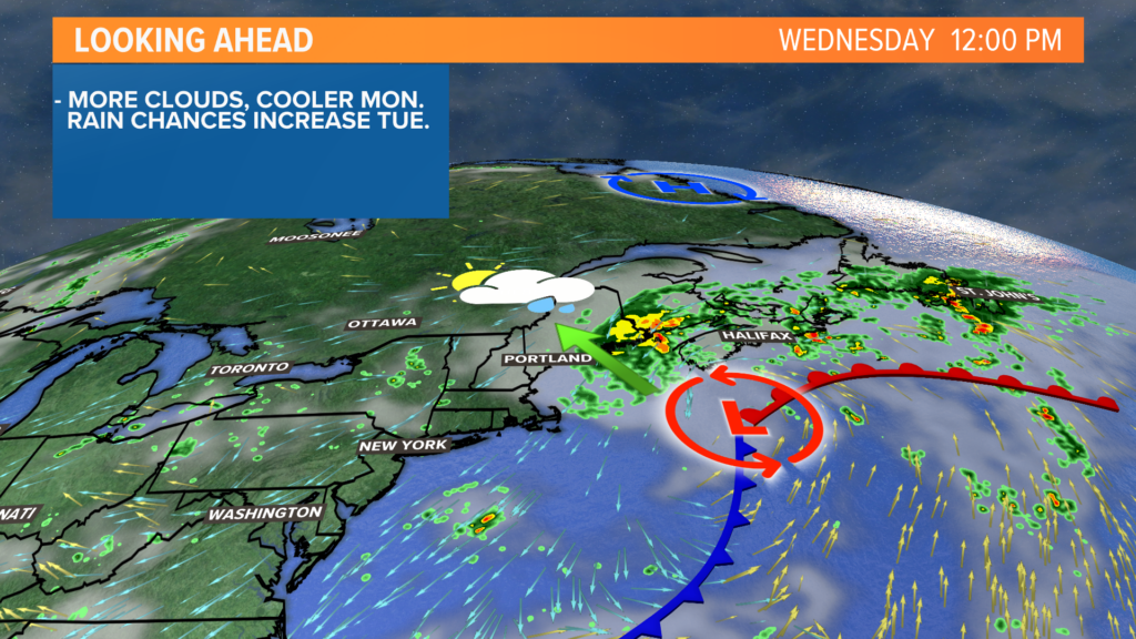
When the soaking rain chance for Wednesday began to slip away, I was not surprised, but I was disappointed.
I still think there will be some rain this week. I just don’t expect it to be the drought buster many had hoped for.
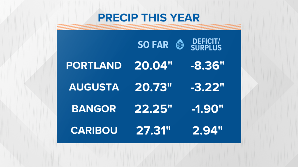
Normally, the greater Portland area would have seen about 28″ of rain, but the annual total sits right near 20″.
Augusta is in a similar boat. While the difference between normal rainfall (around 24″) and the current rainfall (almost 21″) is not as drastic, the rainfall has not been evenly distributed.
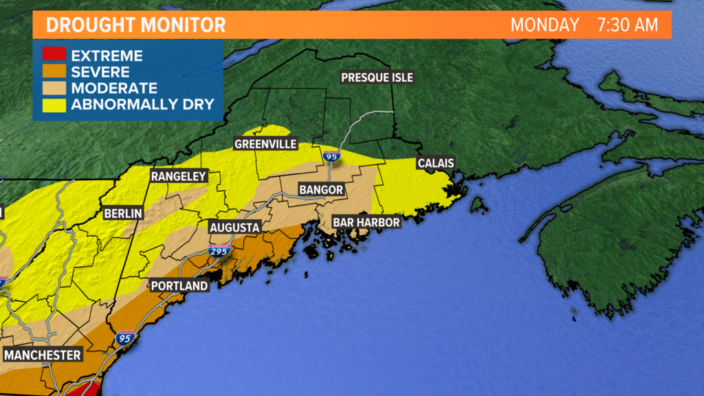
The drought monitor reflects this pretty clearly, too.
While there has been improvement in western Maine, there is still work to be done. The severe drought continues from Kittery through the entire Midcoast.
That area of low pressure is what to watch, but the trend has not been great for keeping soaking rain chances locally.
Still, I think there are two scenarios worth watching.
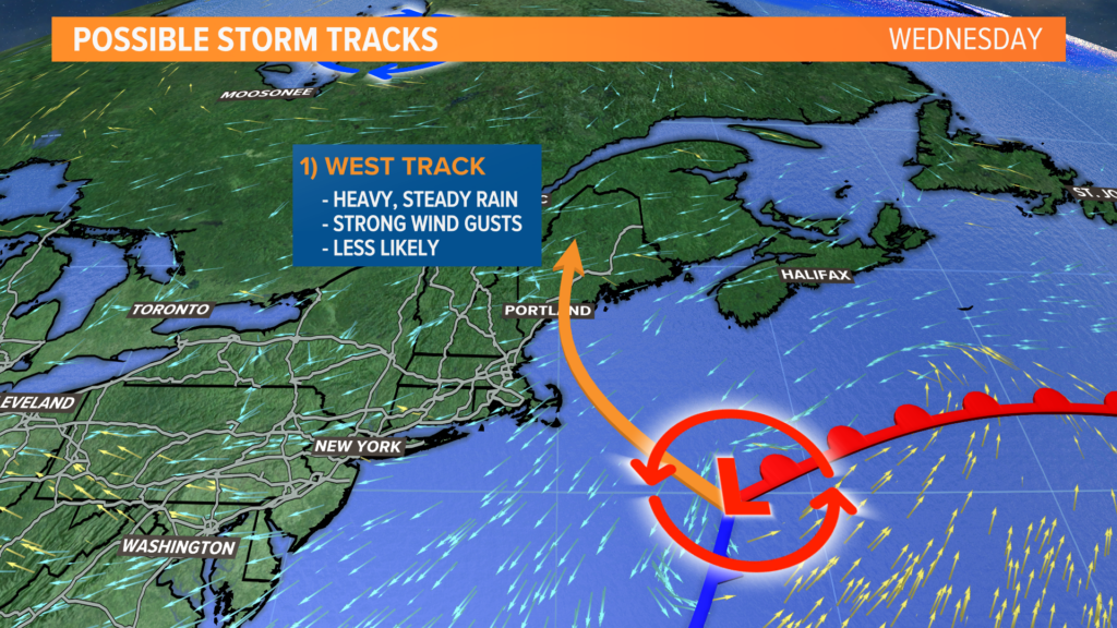
In the first scenario, which is the least likely one, the storm will track west and hit somewhere along the Maine coastline.
This would bring steady, soaking rain to the entire state and New Hampshire. It would be much closer to the “drought buster” scenario, but it comes at a price: power outages.
A storm track like this would likely bring some strong wind gusts to the state, which would be exacerbated by the trees in full leaf.
Thankfully, power outages seem unlikely, since this storm track is less likely to happen. There is still a small chance, though.
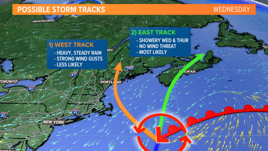
The second possible track seems much more likely to me. This puts the storm out over Nova Scotia and Maine’s rain comes in the form of wraparound precip.
While this would mean no power outage risk for us, it would also mean less rain. The coast would still be breezy and it would feel more like fall outside than mid-August.
Rain totals in this scenario are greatest east of the Penobscot, with an inch or more possible. This is still beneficial given the abnormally dry conditions Downeast.
Showers are still expected all the way to the New Hampshire border, but actual rain totals may be closer to a tenth of an inch. Would it be helpful? Sure, anything is right now!
But it certainly would not be the big drought buster we had hoped.
No matter what happens, at least we will get some rain. Even if it’s only a tenth of an inch, that’s still going to be beneficial for much of Maine.
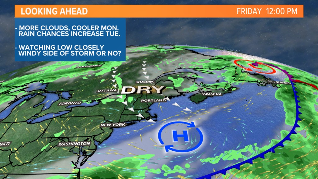
Drier air moves back through Friday with a clearing trend into the weekend. Get ready for (another) beautiful Saturday next week.
Mike Slifer, @MikeSliferWX
Comments are no longer available on this story