
It was a stormy late afternoon and evening in the Lewiston-Auburn area. Isolated thunderstorms popped up Tuesday due to daytime heating and didn’t move for hours.
Reports of nearly 5 inches of rain came in once the storm was gone around 8 p.m. Most of that fell in a very short time. Feet of rain was observed washing over roads and nearly submerging cars.
This was due to “training of thunderstorms,” where a storm stays over the same location for hours. It’s a common meteorological term featuring very little movement in the atmosphere to move storms out.
Another round of strong to severe thunderstorms is expected to move into Maine on Thursday. This will be a statewide event with a strong front triggering the storms.
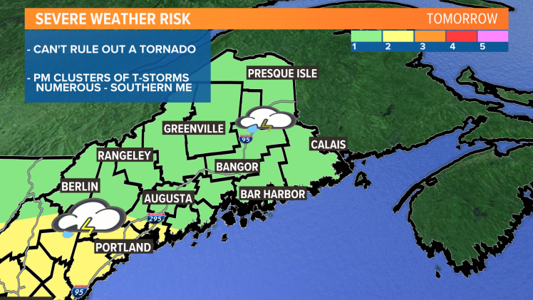
Look for southern Maine to get the worst of it as a level 2 out of 5 threat is in the forecast. I can’t rule out a brief tornado, but this is mostly a wind threat. The storms roll in for the afternoon and evening.
Comments are no longer available on this story