
Maine could see record-breaking temperatures as a heat wave rolls over the state Tuesday.
After cooling down slightly Monday, temperatures are expected to peak in the high 80s for much of the state. In a handful of regions, including the towns of Fryeburg and Lebanon, meteorologists are bracing for 90 degrees or more, the National Weather Service forecasts.
Southern Maine will see the hottest temperatures, said Stephen Baron, a meteorologist at the weather service office in Gray. He pointed to York County and the southernmost part of Oxford County in particular. But things will likely cool down to the 50s and 60s by Thursday, he said.
“It’s kind of a short-term, little summer shot here,” Baron said on a Monday morning phone call.
Portland is predicted to reach 86 degrees, Waterville 89, Lewiston 88 and Augusta 87, according to the weather service. Temperatures will generally be cooler along the coast as a breeze blows off the water.
The heat also triggered an air quality alert for the entire Maine coast, from Kittery to Eastport. The Maine Department of Environmental Protection says that from 10 a.m. until 10 p.m., ozone levels in coastal areas will be unhealthy for sensitive groups, including the very young, older adults, those with preexisting respiratory problems such as asthma, and those with heart disease.
Ozone and particle pollution levels will be in the moderate range in interior regions in the state’s north. The department advises anyone experiencing shortness of breath or other respiratory issues to limit the intensity and duration of outdoor activities.
The high temperatures will also bring a chance of thunderstorms Tuesday, Baron said. He added that northern parts of the state, including the interior and the mountains along Maine’s western edge, are the most likely to see downpours.
But beyond those storms, there is little chance of softer rain.
“It’ll be more isolated, scattered thunderstorms,” Baron said. “You either get one or you don’t.”
POTENTIAL FOR RECORDS
This week’s weather is largely being driven by a ridge — a long stretch of high atmospheric pressure — forming over Maine, Baron said. In this case, the ridge is pushing hot air from the southwest toward the Northeast.
Baron said Portland and Augusta could both set record highs.
Portland’s hottest May 19 was in 1949, when the temperature rose to 87 degrees — just one degree higher than what the weather service is predicting for Tuesday. Augusta’s record was set in 1962, when temperatures soared to 91, Baron said.
“I’d say there’s a shot — certainly a shot — at record heat tomorrow, but whether we actually get there, we’ll see,” Baron said.
Other parts of the state could also see their highest recorded temperatures for this time of year, but Baron cautioned few other towns have weather histories that stretch as far back as Portland and Augusta. For example, Fryeburg’s temperatures may exceed the local record of 87 degrees Tuesday, but that the town’s weather history only goes back to the 1996, so it’s possible that temperatures were higher before then.
By Thursday, a cold front should bring northern air down into Maine, easing the high temperatures, he said.
TAKE CARE, USE CAUTION
Despite the potentially record-setting temperatures, Portland’s cooling center will not open Tuesday. That only happens if the weather service issues a heat advisory or excessive heat warning.
Heat advisories come when the heat index is predicted to exceed 95 degrees for at least two hours or cross 100 degrees for any period of time. Excessive heat warnings are triggered when the heat index is predicted to exceed 105 degrees for at least two hours.
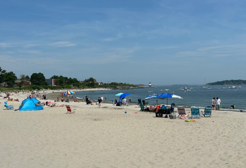
It’s not likely to get that hot Tuesday, but it will be hot. Some Mainers will likely look to beat the heat by taking a swim.
Last week, the weather service issued a notice warning potential swimmers to exercise caution.
Exposure to cold water on a very hot day can lead to shock and hypothermia, increasing an individual’s risk of drowning — even for experienced swimmers, according to the weather service.
Water temperatures along Maine’s coast will be in the mid- to upper 40s on Tuesday, Baron said.
“Even lakes are only just getting above 50 (degrees), so still very cold water there,” he added.
Maine also remains in a monthslong drought, which fuels an elevated risk of wildfires. As of Monday afternoon, all of the state was under moderate or high fire danger, according to the Department of Agriculture, Conservation and Forestry.
Whether on land or in the water, experts said to keep an eye on how you’re feeling.
Baron said people should pace themselves, drink plenty of water and seek shade if they begin to feel overly hot.
“It’s always a good idea to remember that we’re still not used to this heat,” Baron said. “If you have to be outside: take it easy, take breaks.”
We invite you to add your comments. We encourage a thoughtful exchange of ideas and information on this website. By joining the conversation, you are agreeing to our commenting policy and terms of use. More information is found on our FAQs. You can update your screen name on the member's center.
Comments are managed by our staff during regular business hours Monday through Friday as well as limited hours on Saturday and Sunday. Comments held for moderation outside of those hours may take longer to approve.
Join the Conversation
Please sign into your CentralMaine.com account to participate in conversations below. If you do not have an account, you can subscribe here. Questions? Please see our FAQs.