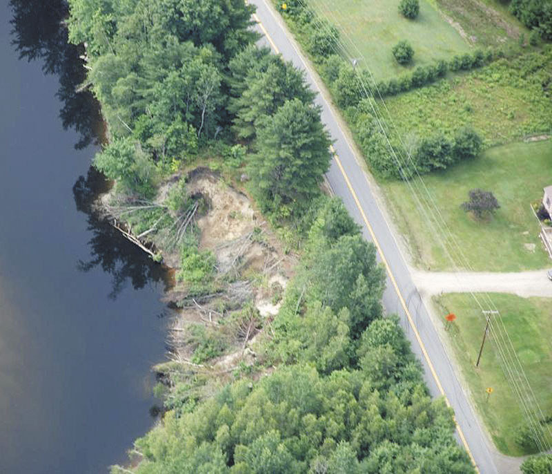
FARMINGTON — A handful of downed pine trees will help town leaders to decide when to close Whittier Road, which is threatened by bank erosion on the Sandy River.
The ground between the road and the river has been eroding since August 2011, when Tropical Storm Irene caused a 50-foot-wide, 300-foot-long section of the riverbank to collapse into the water. Since May, more than nine feet of soil has fallen away, leaving the bank edge within 30 feet of the roadway.
The town sought federal assistance to fund a bank stabilization project that it hoped to complete last summer but work was delayed until next year amid concerns about possible threats to the endangered Atlantic salmon.
In order to address the concerns, raised by the Federal Emergency Management Agency, the town is in the process of drafting a biological assessment of the impact on the salmon population, which uses the Sandy River as a critical spawning ground.
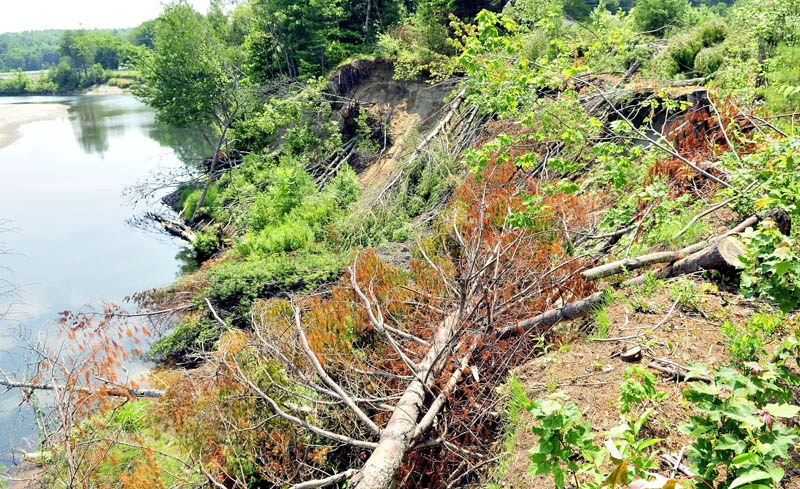
In order to slow the rate of erosion, the town cut down a row of pine trees that had grown on the shrinking strip of earth between the road and the riverbank.
Had they been left standing, the trees would have caught the wind and rocked in the earth, accelerating erosion in a phenomenon described as the sail effect.
Now the trees, which are lying along the riverbank, serve as the canary in the coal mine.
When the disappearing ground causes them to fall from their resting place down the steep embankment, the town will close the road to protect public safety, according to Town Manager Richard Davis.
“The undermined area is starting to get close to them,” Davis said. “I think when those go, it’s time to close it.”
Tim Hardy, the Franklin County Emergency management director, estimated that the road will be within 15-18 feet of the embankment when the trees fall.
In the past, town officials have said that they were seriously considering closing the road when the distance shrunk to less than 30 feet.
The decision to close the road is made more complicated by the presence of an overhang at the edge of the riverbank. Hardy said that the overhang, which is more than four feet, has become more apparent during the last week.
If the overhang suddenly collapses, the distance between the riverbank and the road could change quickly. Davis has said that the overhang contains stumps and roots that are playing an important role in slowing erosion.
Officials have drafted a road closure plan that includes identifying alternative traffic routes and building a new driveway for one resident whose home would be otherwise inaccessible.
Matt Hongoltz-Hetling — 861-9287
mhhetling@centralmaine.com
Send questions/comments to the editors.


Success. Please wait for the page to reload. If the page does not reload within 5 seconds, please refresh the page.
Enter your email and password to access comments.
Hi, to comment on stories you must . This profile is in addition to your subscription and website login.
Already have a commenting profile? .
Invalid username/password.
Please check your email to confirm and complete your registration.
Only subscribers are eligible to post comments. Please subscribe or login first for digital access. Here’s why.
Use the form below to reset your password. When you've submitted your account email, we will send an email with a reset code.