
Meteorological autumn arrived on Sept. 1, marking the 90 days between the warmest and the coldest seasons of the year. Typically we would find mild days and crisp cool nights as the dominating weather during this period, but this year is continuing a trend of milder-than-average falls.
A cold front passed off the coast overnight and now less humid air is arriving from the west. It’s still muggy this morning, but the 70-degree oppressive humidity is being shunted out to sea.
Temperatures today will reach the 70s and many places in the upper 70s. This will be the case right to the coastline on a westerly flow of air. These temperatures are 10-18 degrees above average and more typical for early to mid-June.
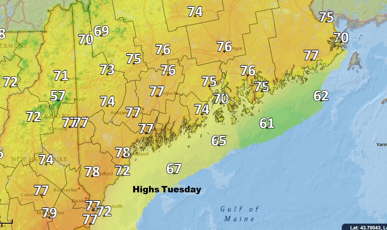
Highs Tuesday will be more typical for summer, not autumn. Dave Epstein
Finally tonight we’ll have a cool night that will be pleasant for sleeping. With low dew points and mainly clear skies many areas should fall into the 50s and even some 40s.
A weak weather system will increase cloud cover Wednesday. It will be a day averaging partly sunny, but most of the sunny is in the first half of the day and the partly comes later in the afternoon. While we did receive some rain Sunday and Monday we need a lot more. Yet a sprinkle Wednesday night is about the most we can expect.
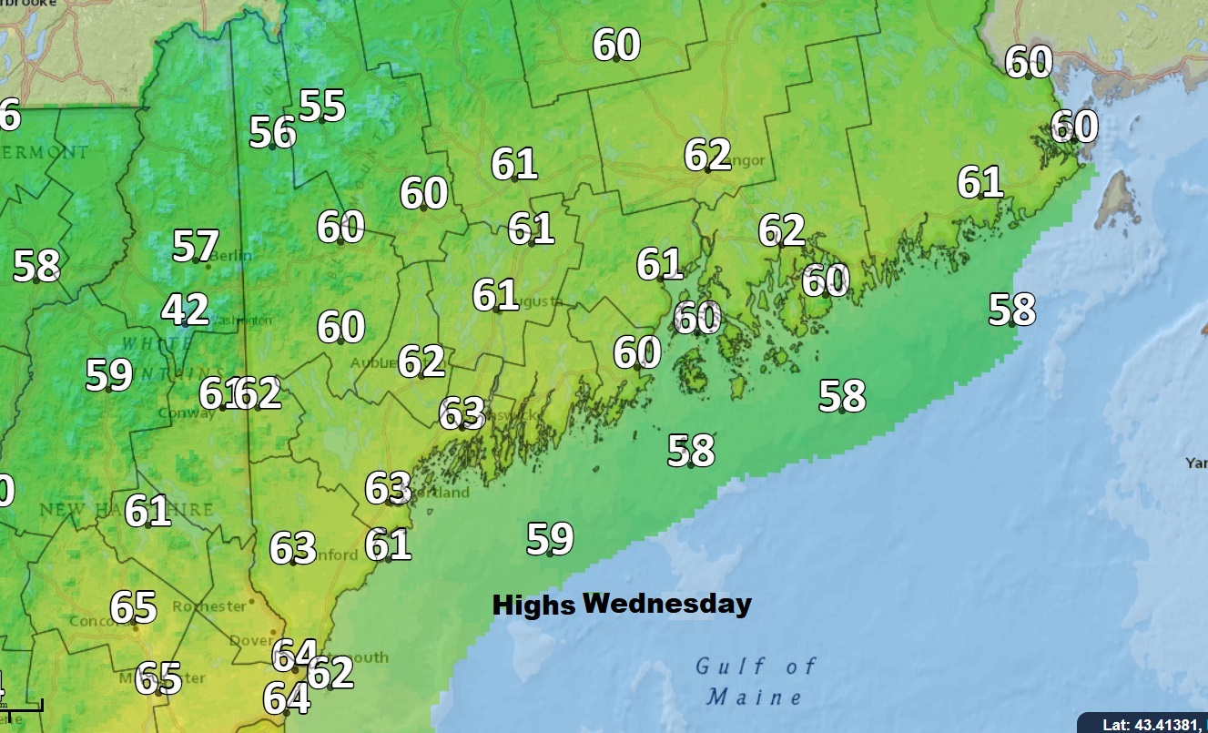
It will be much cooler Wednesday across Maine and New Hampshire. Dave Epstein
The pattern continues to be not only warm, but dry and after the drought of 2016, it would be very unhealthy for trees and shrubs to enter winter this dry. We shall see.
While temperatures will be more seasonable the rest of the work week, I do see more warm and perhaps even muggy air coming back this weekend. The upper level flow in the atmosphere continues to keep a ridge here in the East and a trough out West. That translates into much warmer air here and much colder air there. There can be cool days, but overall the pattern is exceedingly warm.
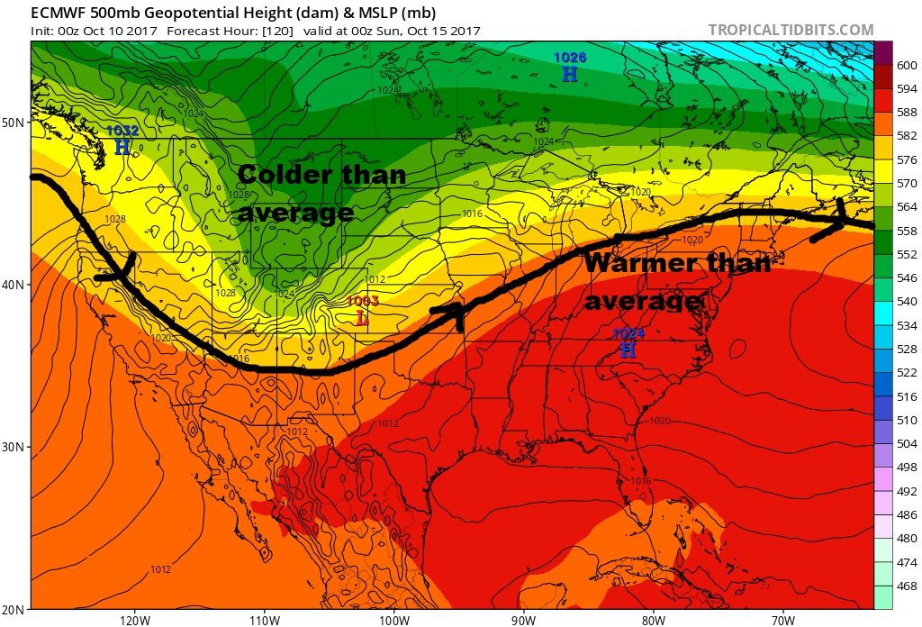
A ridge is the predominant weather feature in the East keeping warm air in the picture. Tropical Tidbits
As long as this pattern keeps going, the weather won’t feel very cool for any extended period of time and frosts and freezes will be limited. Falls are getting warmer in New England, but this year is particularly out of the norm.
You can follow my updates here and on Twitter @growingwisdom.
Comments are no longer available on this story