
The biggest Christmas snowstorm in 15 years slammed into Maine on Monday morning, bringing whiteout conditions and up to a foot of snow to much of the state.
The National Weather Service in Gray called off a blizzard alert for southern, western and midcoast Maine by 2 p.m. Monday as the winter storm pushed into the eastern half of the state. The weather service warned Monday night that blowing and drifting snow could impair driving.
The storm was intense, but brief. Sunlight was breaking through the clouds by early afternoon as people emerged from inside to play in the fresh powder.
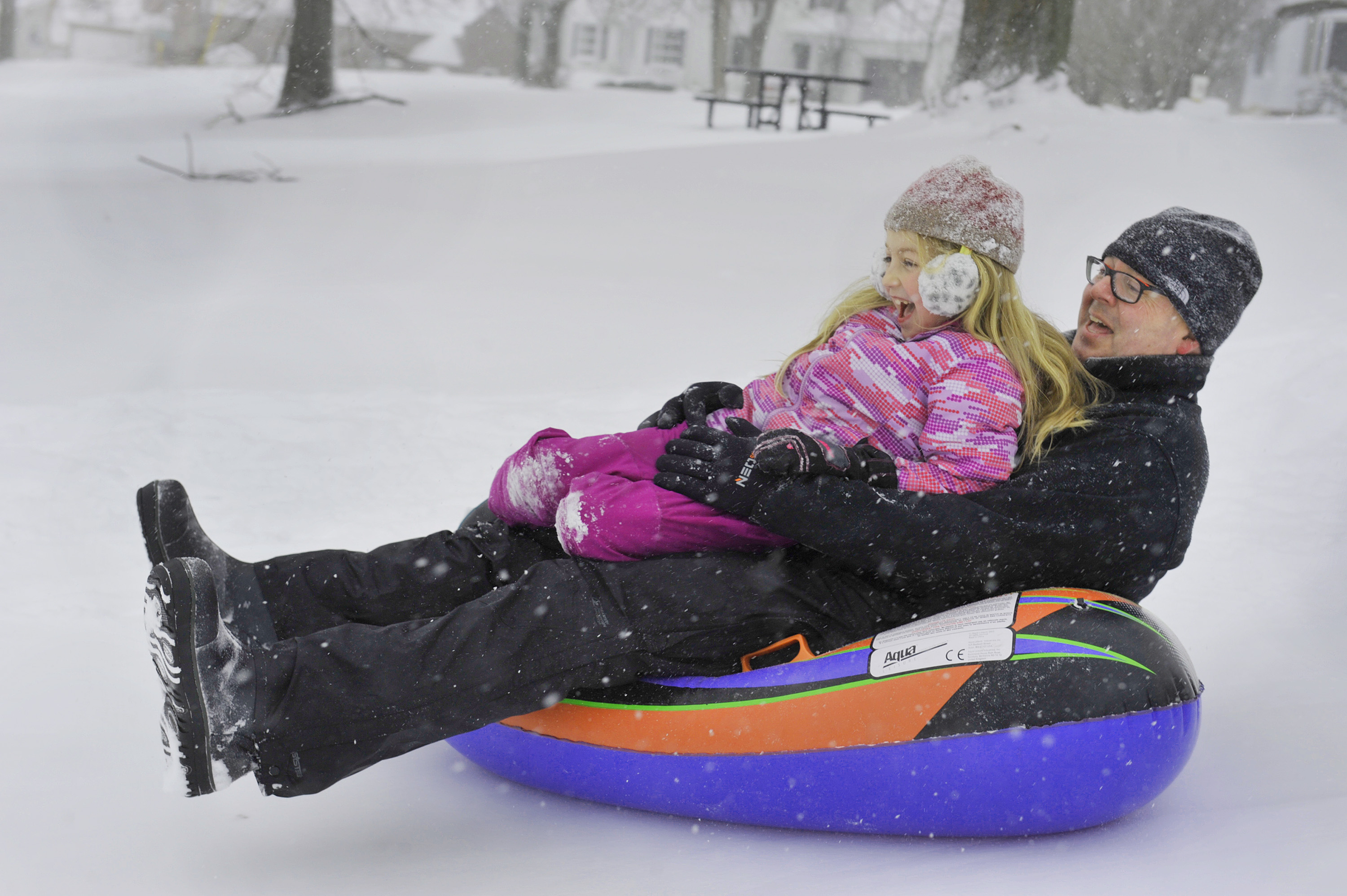
Jonathan Graffius of Portland and his daughter Lucy, 7, had the sledding hill at Payson Park all to themselves on Christmas afternoon. John Ewing/Staff Photographer
“We did see the heaviest snowfall in the morning hours,” said Margaret Curtis, a meteorologist at the National Weather Service in Gray. “We expect winds to continue to be kind of gusty this afternoon.”
During the height of the storm, the weather service reported snow falling at 2 to 4 inches per hour in some places, making travel “very dangerous to impossible.” Speed limits on the Maine Turnpike were reduced to 45 mph Monday morning. The turnpike authority reported a slide-off between Saco and Scarborough about 8 a.m. and several other cars off the road during the day.
Snowfall amounts ranged widely, from more than a foot near Lewiston-Auburn to 5 inches in Portland. Bands of snow in the storm track contributed to the uneven snowfall, Curtis said.
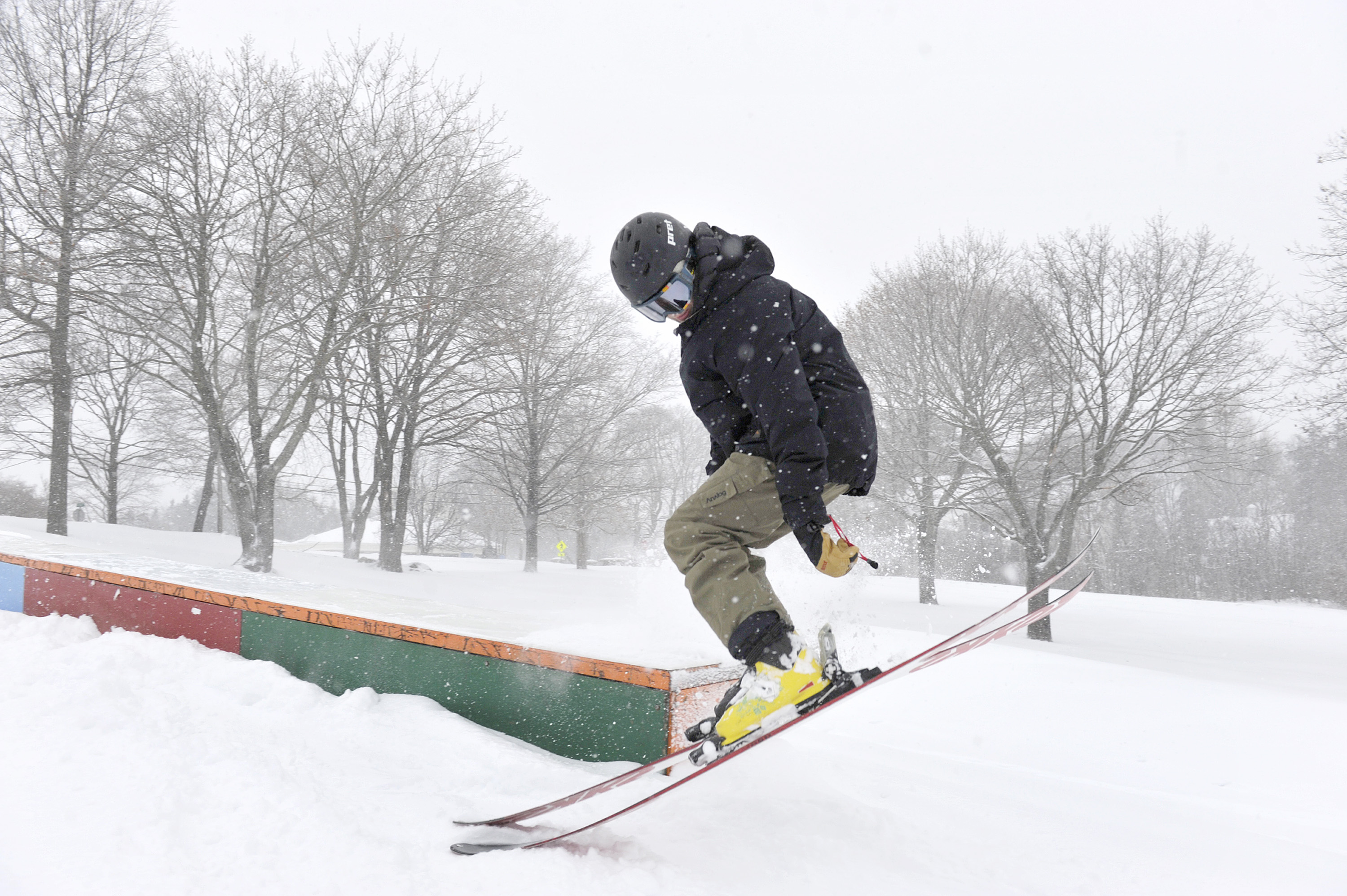
Portland native Mack Fisher got in some ski jumping at Payson Park while home for the holiday from Venice Beach, California, Monday. Staff photo by John Ewing
“There was quite a bit of variability around and some nice snow bands in this storm,” she said. “There were some big variations over distances.”
Maine State Police received about 50 reports of cars off the road at various times Monday, according to a dispatcher in Gray. Poor visibility appeared to be the primary cause of many of the crashes, he said.
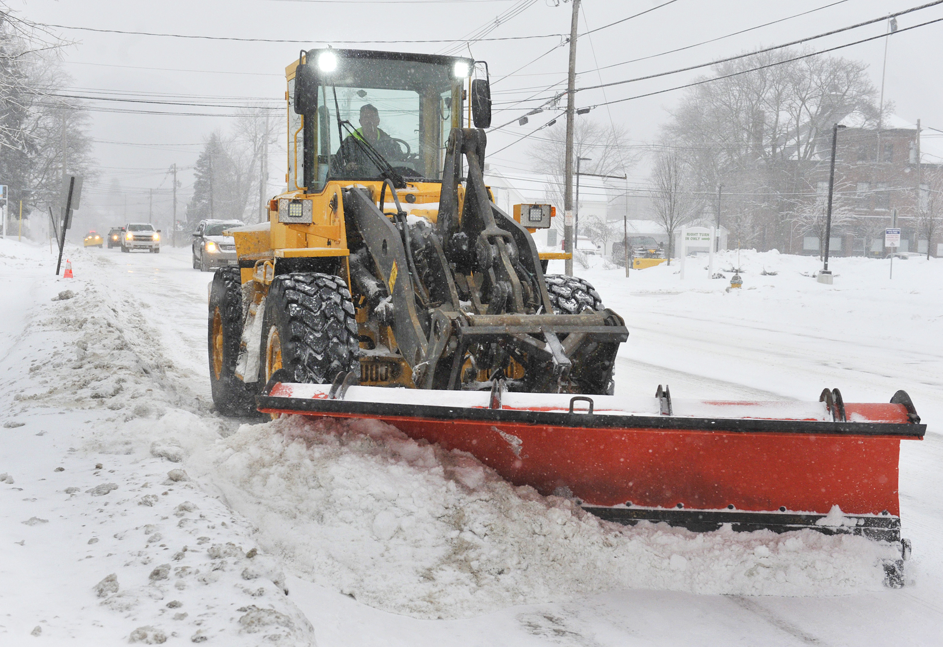
A Portland city plow clears snow from Stevens Avenue Monday. Staff photo by John Ewing
The weather service cautioned that winds as high as 50 mph, coupled with tree branches already weighed down with ice from Saturday’s storm, were likely to cause power outages. More than 2,000 Central Maine Power customers were without electricity at one point during the storm.
Bowdoinham, in Sagadahoc County, was the hardest hit. Almost 1,000 customers there – more than half of the customers in the town – lost power for at least an hour. In Falmouth, almost 870 customers reported outages, but power to most of them was restored by 1:30 p.m. and fewer than 100 customers were out of power by Monday afternoon.
Although no flights from the Portland International Jetport were canceled, some departures were delayed two hours.
National Weather Service data via Twitter
Some towns announced parking bans in advance of the storm. Falmouth prohibited street parking until 10 p.m. Monday and Scarborough placed a ban until 11:30 p.m. Brunswick had a ban until
7 a.m. Tuesday. There was no parking ban in Portland, but in an alert the city asked people to park off street and use city parking ban lots, since garages were not open. Portland expects a parking ban Tuesday for cleanup, according to the alert.
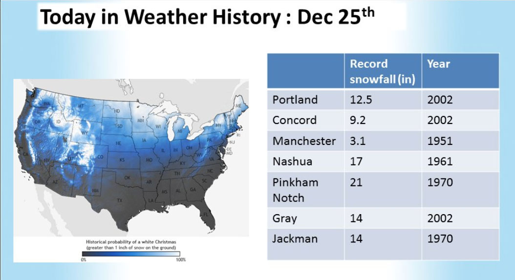
The storm was expected to bring about 10 inches of snow across most of southern Maine, making it the biggest Christmas Day storm since 2002, when Portland got 12.5 inches of snow and Gray got 14 inches. Weather observers reported unofficial accumulations of 13 inches in New Gloucester and 11 inches in Gray, as well as a foot of snow in Buxton, in York County, and 13.5 in Bangor, according to the weather service. Five and a half inches were recorded at the jetport, 6 inches in Yarmouth and 7 inches in Saco.
There are no more storms on the immediate horizon, but Maine is set for a deep freeze, the weather service said. A high of 26 is expected Tuesday, and temperatures will dip below zero overnight, Curtis said. Wednesday and Thursday will have highs in the single digits.
“It is just going to get colder over the week,” Curtis said. “No storms, just very cold.”
Peter McGuire can be reached at 791-6325 or at:
Twitter: @PeteL_McGuire
Comments are no longer available on this story