
As with any late season snow potential, one or two degrees can be the difference between heavy snow and cold rain. With this in mind, my thoughts on what to expect are below.
Monday morning features snow for most of inland Maine, with a mix along the coastline. Wind gusts will also be a bit stronger, too. Expect some delays for the commute, even with the lower amount of traffic on the roads.
Through the day on Monday, snow likely continues in the mountains. Outside of the mountains, I still think there will be on and off snow showers mixing with rain. It will be hard to accumulate more snow during the day, due to the strong April sun. Even behind the clouds, the sun’s strength should be enough to prevent snow from accumulating much during the daytime hours.
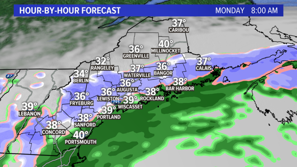
Along the coastline, especially from Sagadahoc county and south through Portland and into York county, there will likely be mostly rain showers with some mixing through the day.
Overall, it will be a raw, windy day with temperatures struggling to make it above 40 degrees across the state.
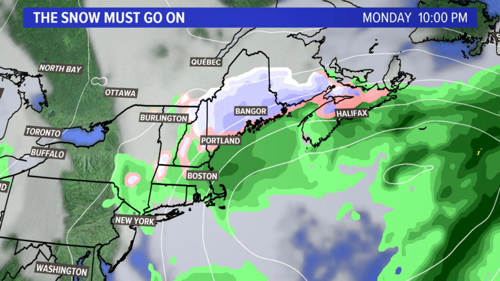
The rain/snow line crashes south yet again late Monday. The storm shifts east, pulling colder air south with it.
While snow ends in the mountains, it falls through the Lewiston and Augusta regions again. It also makes a last run at the coastline, and seems like the most likely time for the coast to get some accumulating snow.
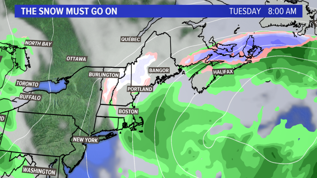
Some lingering snow or mixed showers are expected on Tuesday. Accumulation looks unlikely and these showers will be much lighter in nature.
It will also be a gloomy, breezy day, though I think we mix in a few high temperatures in the 40s.
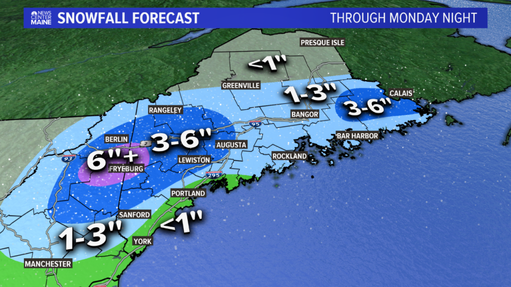
Here’s the updated forecast by the time all is said and done. Areas near Fryeburg that end up with 6″ or so could see some power issues pop up.
Through Lewiston and Augusta, a solid 3-6″ looks likely. I expect totals to be on the lower side of this range, but still enough for a couple of isolated outages. This is a similar story for interior Washington county.
Bangor, most of the Midcoast, and the Downeast coastline will end up in the 1-3″ range.
The County gets less than an inch overall, but everything that falls will be frozen.
Brunswick, Portland, and along the southern coast will get up to a slushy inch.
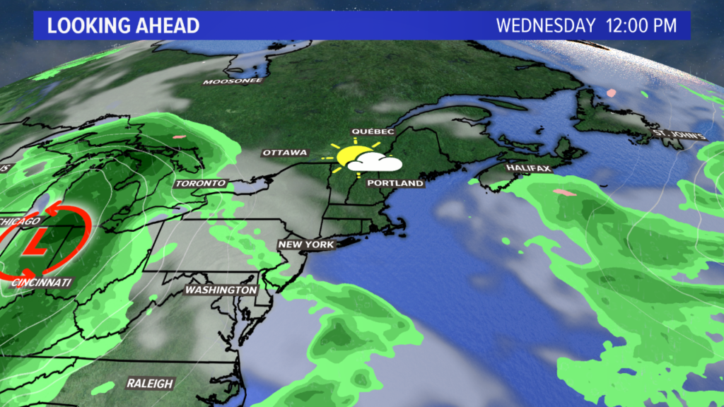
Wednesday looks like a pretty nice day, but temperatures will still be below average for this time of year.
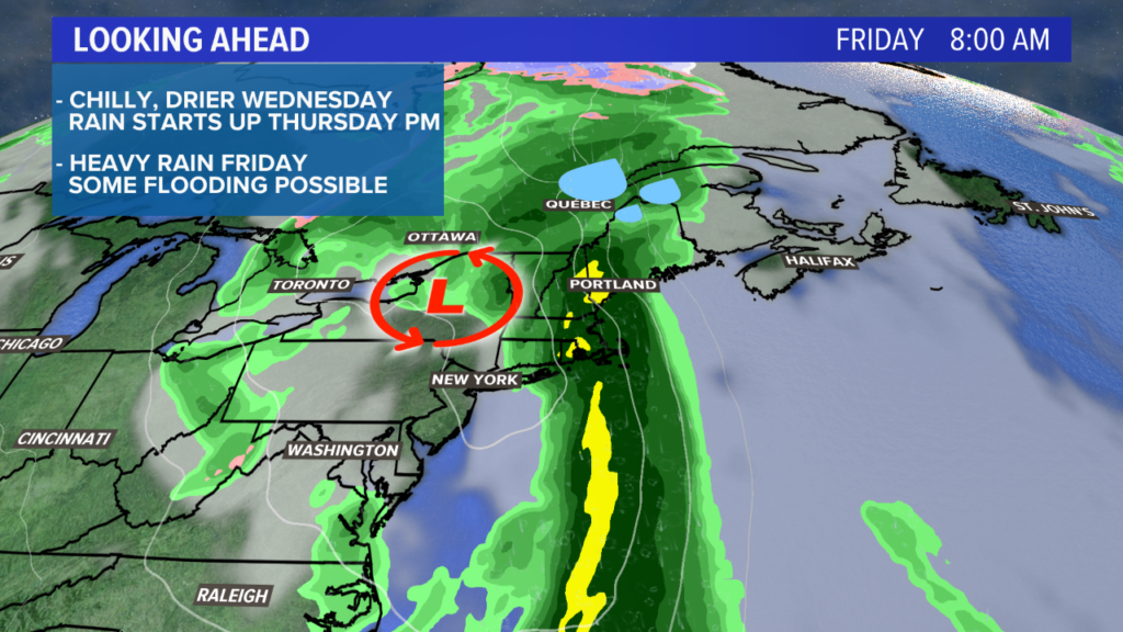
Thursday will feature a big warm up ahead of our next storm. Heavy rain is possible Thursday night and into Friday, leading to the chance for some localized high water to start off May.
It will be warmer though…so we’ve got that going for us, which is nice.
Follow me on Twitter and Facebook for more forecast info and more references to random 80s movies.
Comments are no longer available on this story