
The weekend storm was pretty impressive! Rain totals for most ended up over an inch. Auburn recorded 2.05″ of rain from that storm.
Snow was also most prevalent in the areas where it was needed. The mountains and northern Maine had snow totals ranging from just a few inches to over a foot in some spots.
While this pattern could favor a little more snow, it looks pretty light with minimal accumulations.
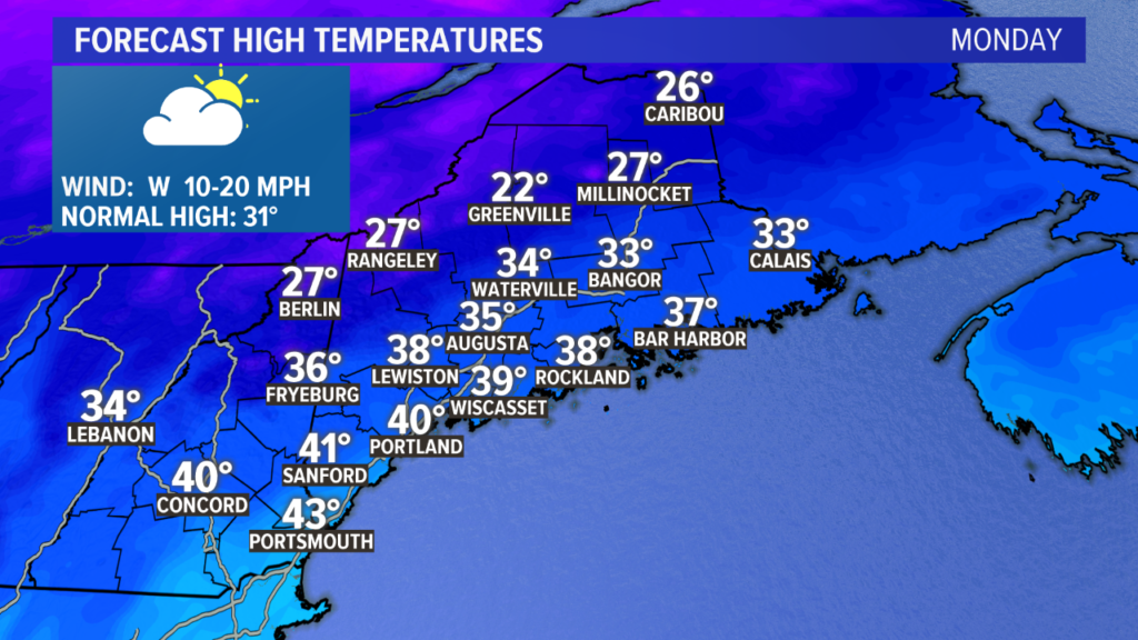
Monday will be the last really mild day for while. High temperatures will end up in the mid to upper 30s inland and low 40s near the coastline. The breeze will relax later in the day.
Clouds clear gradually through the afternoon, giving way to partly clear skies for the evening.
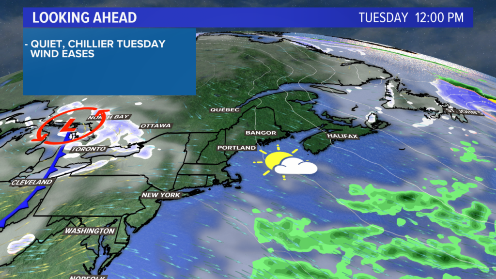
A calmer, colder day is in store Tuesday. High temperatures will be in the upper 20s inland and low 30s at the coastline. In other words, high temperatures will be pretty average for this time of year.
Partly sunny skies and calmer winds will make for a pretty good January day.
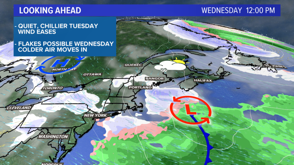
Overnight, a weak disturbance passes overhead. This will allow for some flurries or light snow showers into Wednesday. Expect cloudy skies for the whole day. Temperatures will be in the 20s inland, near 30 along the shore.
Snow totals aren’t really part of the conversation, though. The showers that move through will be weak. Some people may see a light dusting collect on car rooftops, but I don’t think there will be much in the way of impacts.
This does open the door for some colder air, though.
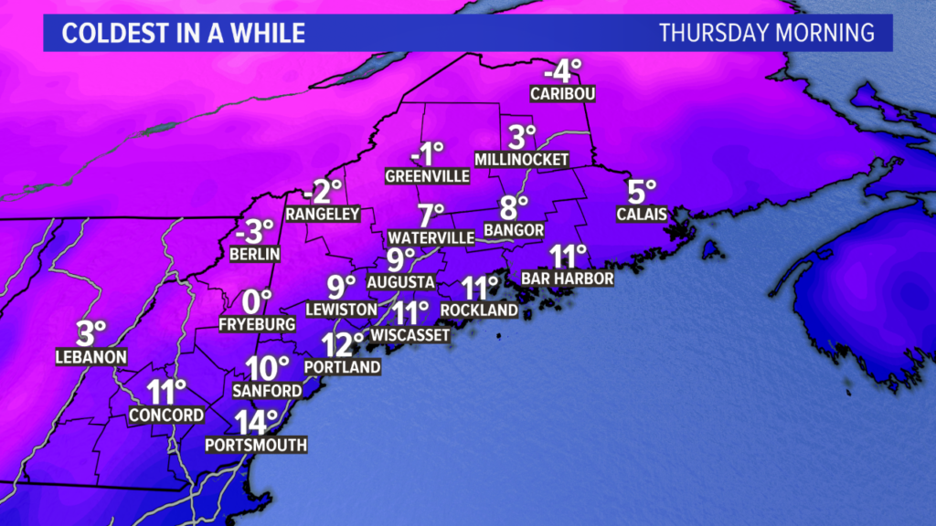
Thursday morning will be the coldest we’ve seen in a while. Temperatures at the coast will settle in the upper single digits and low teens; inland areas will be between zero and ten; mountains fall below zero.
Believe it or not, this is about normal for this time of year. Portland’s average low temperature is 13 degrees while Augusta’s is 10 degrees.*
*(these are based off the 1980-2010 climate averages. The 1990-2020 climate averages will be posted from NOAA in May, and will likely reflect a warming trend for overnight low temperatures which has been observed over the last couple of decades. There will be an article on this details of this when the new numbers are released)
The rest of the day will feature increasing cloud cover out ahead of another weak system.
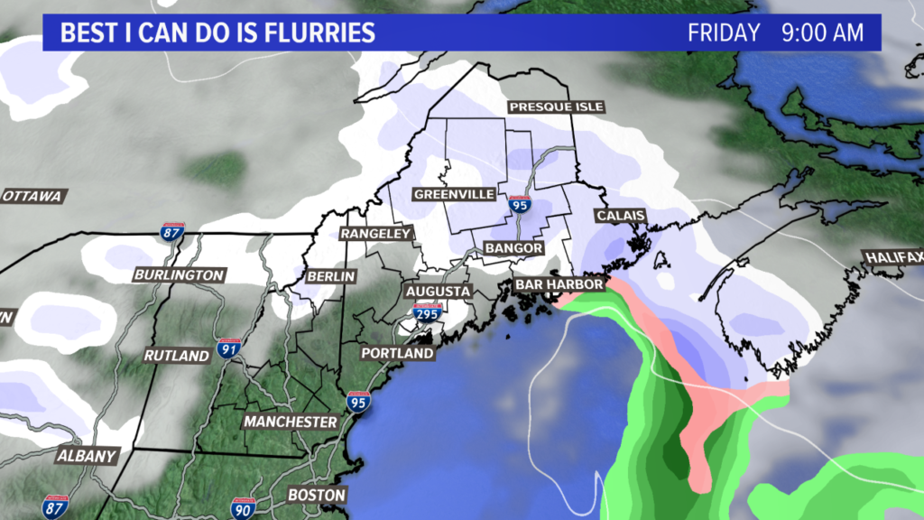
Some flurries are possible Thursday evening, but there will be a better chance during the day on Friday for some light snow.
Accumulations look pretty meager as of now.
Saturday and Sunday both look brighter, brisker, and blustery. The next big storm threat looms for somewhere in the January 26 time frame. More details on that next weekend.
For other forecast info, follow me on Twitter, @MikeSliferWX.
Comments are no longer available on this story