
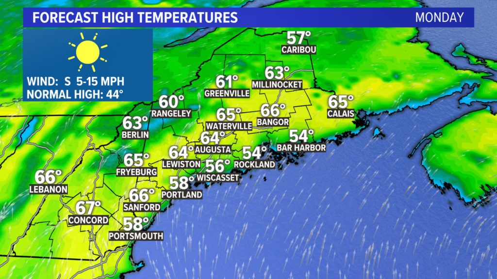
What an incredible start to the new season. Wall-to-wall sunshine and temperatures 15 or 20 degrees above average!
I know … the skiers may not be too happy about this forecast, but it’s pretty incredible just how warm and dry this stretch has been. This is a bit of a double-edged sword, though.
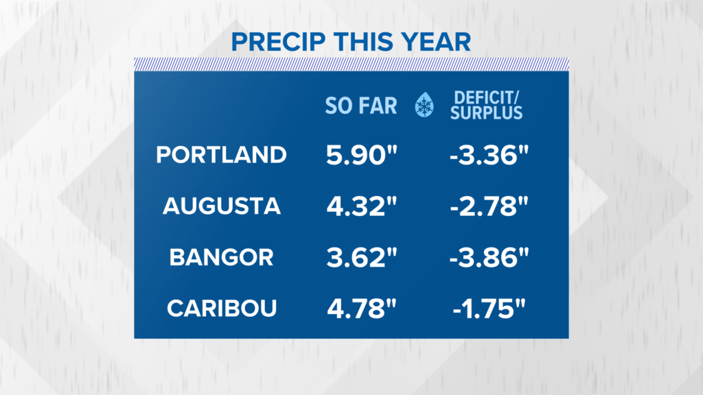
Since the beginning of the year, the lack of rain and snow has made for some fairly big deficits. The dry, warm days contribute to higher fire weather risks since the snowpack has receded so far north.
Be mindful of your burning and follow burn laws, especially on days like Monday.
That’s right.
Full sunshine and upper 50s at the coast, low to mid 60s inland. It’s going to be a gorgeous day Monday.
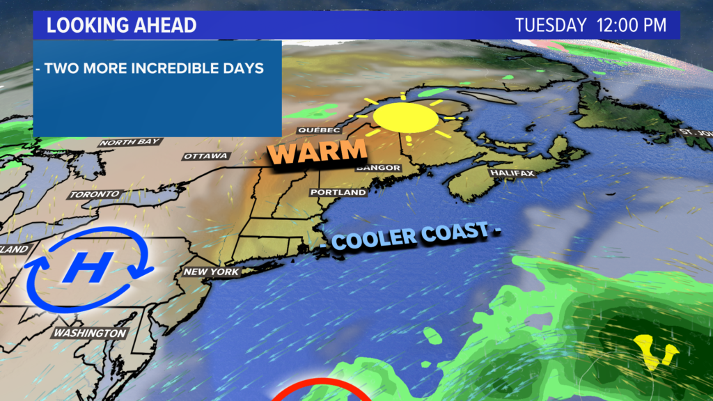
Tuesday will be similar but maybe a couple degrees cooler. Increased onshore flow means the coastline will be five or so degrees lower than inland areas.
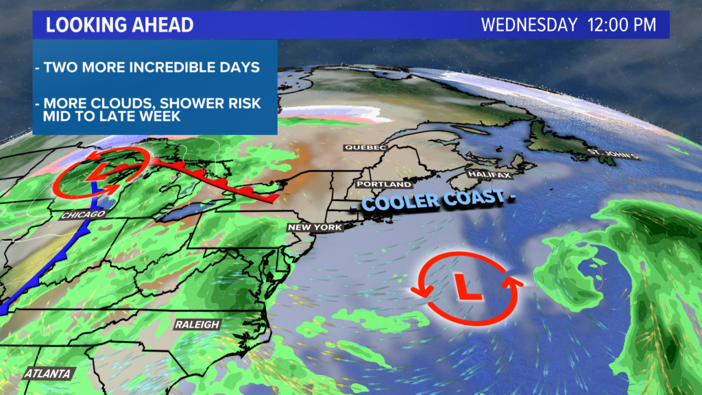
Clouds increase a little bit on Wednesday. It will be cooler than Tuesday, with temperatures in the 50s.
A little bit of drizzle or mist will be possible along the coastline. Shower chances increase slightly for Thursday morning.
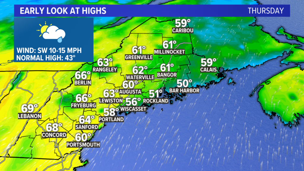
Despite the risk for morning showers, Thursday afternoon looks pretty great. Sunshine returns with high temperatures approaching 60 yet again.
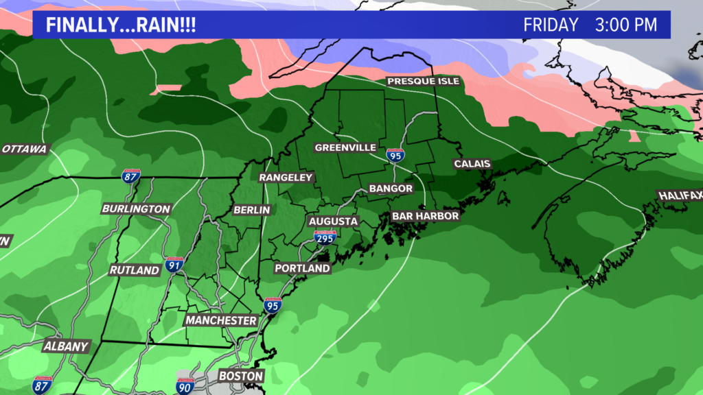
Friday still looks increasingly unsettled. With temperatures in the 50s, it will be all rain.
And, given the deficits, I would say it’s much needed.
The first glance at next weekend favors a nicer Saturday than Sunday. There are some signals of another storm approaching for the beginning of the following week.
For more forecast info and other meteorological musings, follow me on Twitter, @MikeSliferWX.
Comments are no longer available on this story