
March: in like a lion, out like a lamb.
This year, I can tell you that the first half of this statement is true. Jury’s still out on the second half…but I’m sure we’ll chat about that in four weeks to see how it plays out.
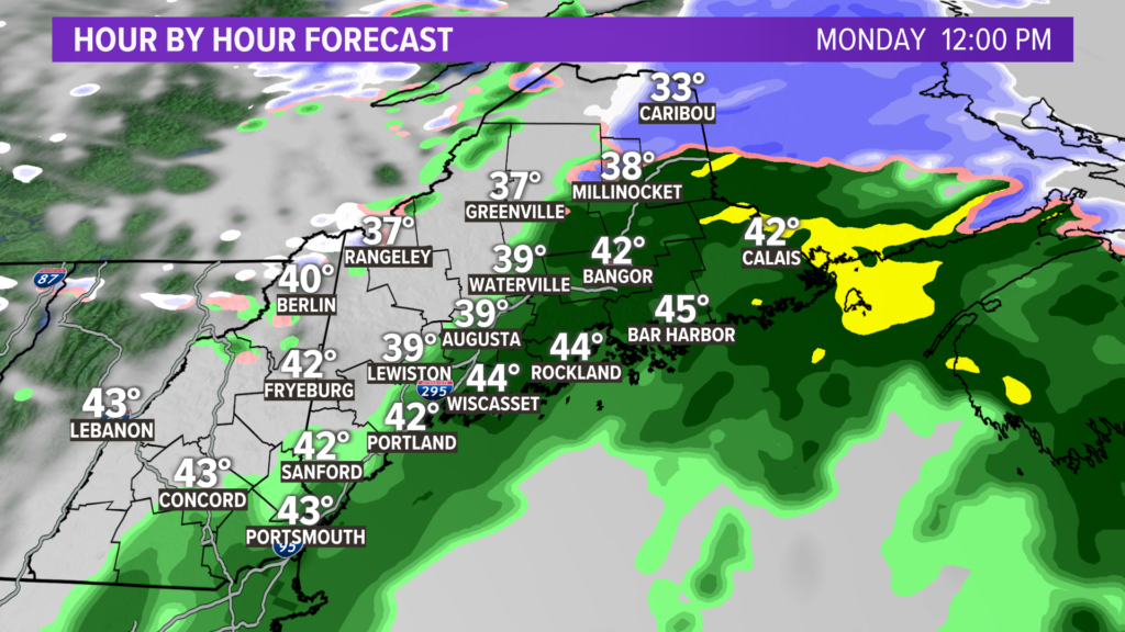
Monday will be a bit of a dreary day, with rain showers in the morning and some snow in the mountains. The showers break a bit in the afternoon, allowing for a bit of dry time. There could even be some breaks of sun.
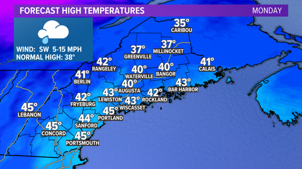
High temperatures will be on the milder side again. Most will end up in the upper 30s to mid 40s. This is slightly cooler than what I thought earlier in the week, but still not bad for this time of year.
Don’t get too used to it. Big changes come in the evening.
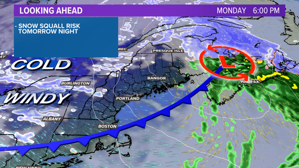
An Arctic front will push through. Some snow squalls are expected with the frontal passage, especially in the mountains.
It could be tough to get around western Maine as the squalls move in, bringing reduced visibility and snow-covered roads with them. They wrap up by 11 p.m. Monday.
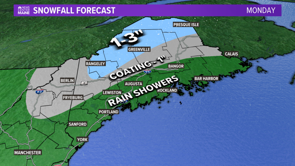
Snow totals will be kept mostly in northern and western Maine from this weak system. The further south you are, the more likely it is that you just deal with rain.
The key to the forecast with this front, though, is that it opens the freezer door.
By Tuesday morning, air temperatures will be down into the single digits across inland sections. There will be strong wind gusts out of the northwest, too.
Add cold air and wind gusts, and you’ve got the perfect recipe for wind chills….or the “feels like” temperature.
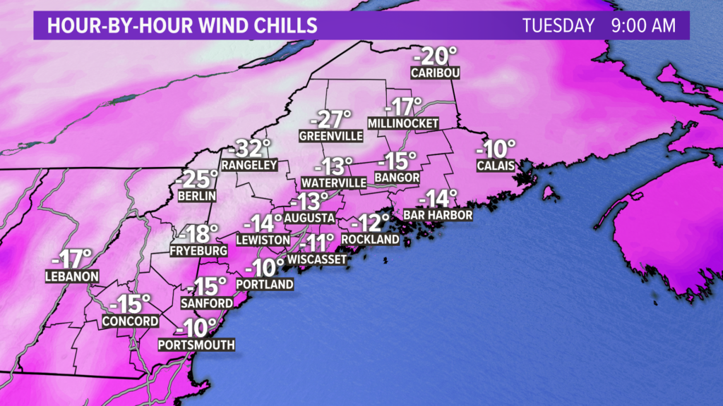
Wind chills across all of Maine will be below zero on Tuesday morning.
Across the high terrain, wind chill values could fall as low as 30 or 35 below zero. Frostbite can occur in 10 minutes under these conditions.
This will be one of the coldest days of the winter season.
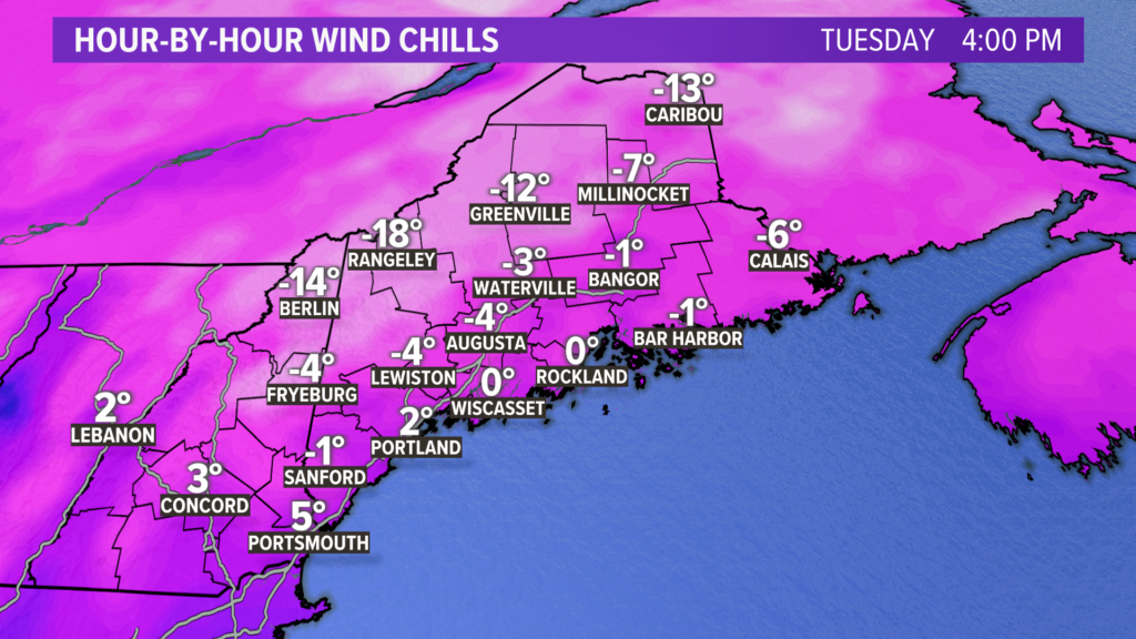
Minor improvements are expected in the afternoon. The coast will feel more like zero as Tuesday wraps up, while inland sections still feel like they are below zero.
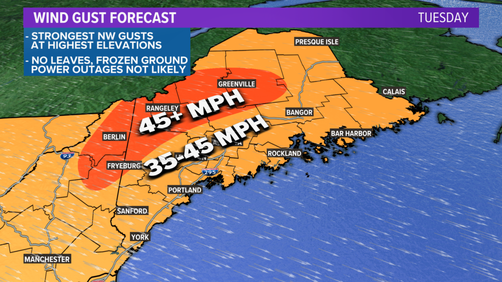
Wind gusts top out at 45 mph or higher along the ridges. Elsewhere, frequent gusts into the 35-45 mph range are expected.
So, does this mean power outages? Actually, probably not.
The frozen ground and leaf-less trees should be able to handle these northwest gusts. There could be some isolated issues, but I do not expect anything widespread.
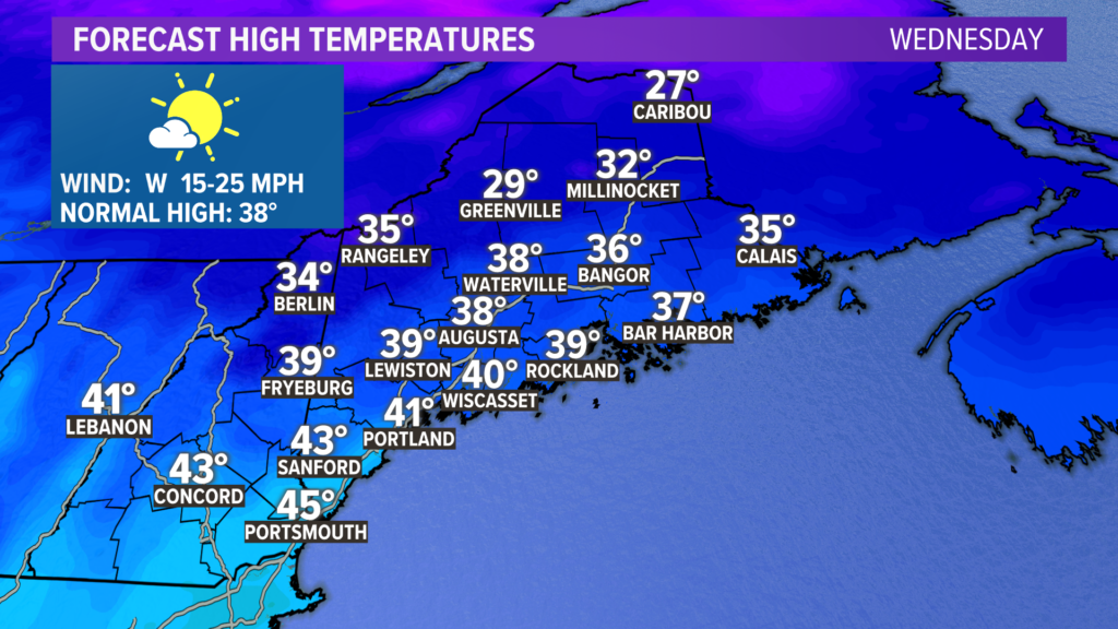
And just like that, it’s gone. Wednesday looks good – in fact, it could be slightly above average.
Thursday through Saturday will be a bit breezy at times with temperatures running on the colder side. I don’t think it will be nearly as cold as Tuesday, though.
Sunday looks a bit warmer with more sun. Shower chances remain quite low after Monday, with no appreciable rain in the forecast as far as the eye can see.
Don’t look now, but the middle of next week might bring some days that approach 50. We’ll see what happens after that.
For more forecast info, follow me on Twitter, @MikeSliferWX.
Comments are no longer available on this story